You are here: Home > Network List > CN - Canadian National Seismograph Network Stations List
> Station INK INUVIK, NT > Earthquake Result Viewer
INK INUVIK, NT - Earthquake Result Viewer
*The percent match for this event was below the threshold and hence no stack was calculated.
| Earthquake location: |
Komandorskiye Ostrova Region |
| Earthquake latitude/longitude: |
55.1/165.7 |
| Earthquake time(UTC): |
2018/01/07 (007) 02:24:06 GMT |
| Earthquake Depth: |
35 km |
| Earthquake Magnitude: |
5.7 mb |
| Earthquake Catalog/Contributor: |
NEIC PDE/us |
|
| Network: |
CN Canadian National Seismograph Network |
| Station: |
INK INUVIK, NT |
| Lat/Lon: |
68.31 N/133.53 W |
| Elevation: |
44 m |
|
| Distance: |
30.3 deg |
| Az: |
40.092 deg |
| Baz: |
274.942 deg |
| Ray Param: |
$rayparam |
*The percent match for this event was below the threshold and hence was not used in the summary stack. |
|
| Radial Match: |
36.14725 % |
| Radial Bump: |
400 |
| Transverse Match: |
65.84284 % |
| Transverse Bump: |
400 |
| SOD ConfigId: |
13570011 |
| Insert Time: |
2019-04-29 12:35:33.751 +0000 |
| GWidth: |
2.5 |
| Max Bumps: |
400 |
| Tol: |
0.001 |
|
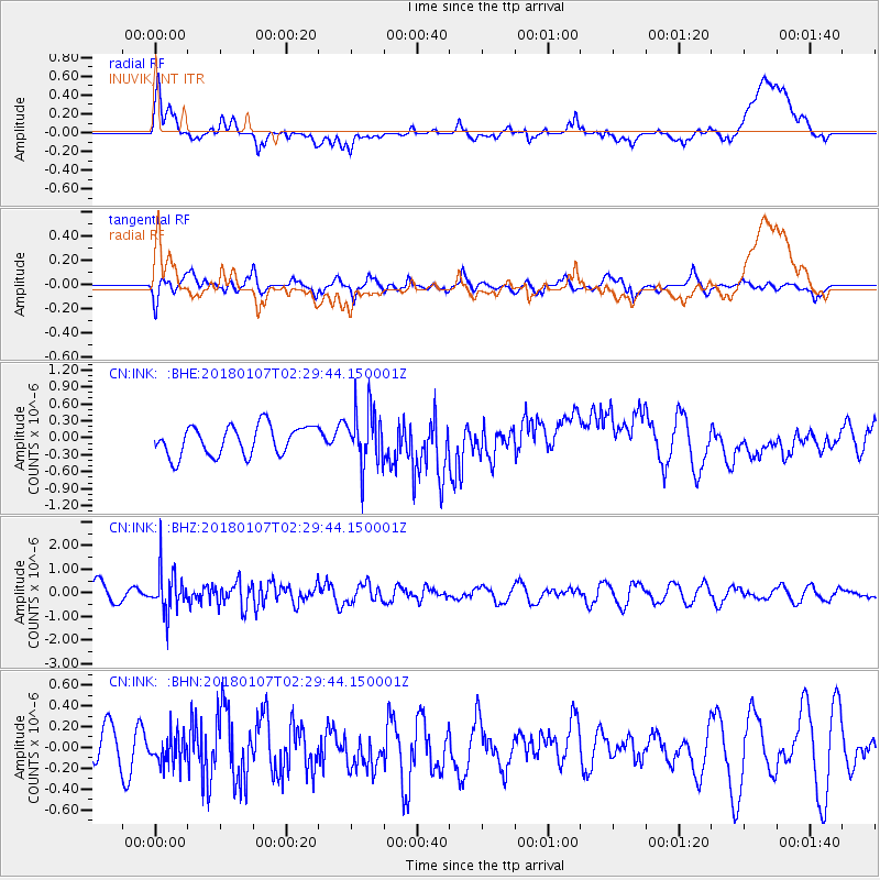
Signal To Noise
| Channel | StoN | STA | LTA |
| CN:INK: :BHZ:20180107T02:29:44.150001Z | 1.7542286 | 8.2713643E-7 | 4.7151005E-7 |
| CN:INK: :BHN:20180107T02:29:44.150001Z | 0.6143635 | 1.451028E-7 | 2.3618396E-7 |
| CN:INK: :BHE:20180107T02:29:44.150001Z | 1.8609744 | 4.841323E-7 | 2.6014987E-7 |
| Arrivals |
| Ps | |
| PpPs | |
| PsPs/PpSs | |


