You are here: Home > Network List > IU - Global Seismograph Network (GSN - IRIS/USGS) Stations List
> Station GRFO Grafenberg, Germany > Earthquake Result Viewer
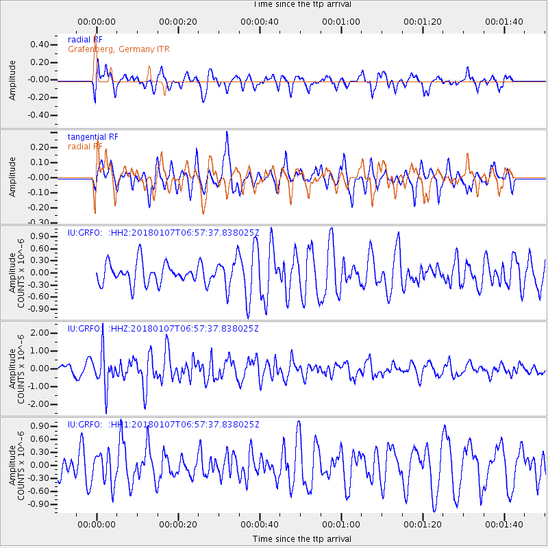
GRFO Grafenberg, Germany - Earthquake Result Viewer
*The percent match for this event was below the threshold and hence no stack was calculated.
| Earthquake location: |
Myanmar-India Border Region |
| Earthquake latitude/longitude: |
24.8/94.9 |
| Earthquake time(UTC): |
2018/01/07 (007) 06:47:14 GMT |
| Earthquake Depth: |
23 km |
| Earthquake Magnitude: |
5.5 Mww |
| Earthquake Catalog/Contributor: |
NEIC PDE/us |
|
| Network: |
IU Global Seismograph Network (GSN - IRIS/USGS) |
| Station: |
GRFO Grafenberg, Germany |
| Lat/Lon: |
49.69 N/11.22 E |
| Elevation: |
384 m |
|
| Distance: |
67.6 deg |
| Az: |
315.707 deg |
| Baz: |
77.853 deg |
| Ray Param: |
$rayparam |
*The percent match for this event was below the threshold and hence was not used in the summary stack. |
|
| Radial Match: |
64.352135 % |
| Radial Bump: |
400 |
| Transverse Match: |
54.264046 % |
| Transverse Bump: |
400 |
| SOD ConfigId: |
13570011 |
| Insert Time: |
2019-04-29 12:43:42.238 +0000 |
| GWidth: |
2.5 |
| Max Bumps: |
400 |
| Tol: |
0.001 |
|
Signal To Noise
| Channel | StoN | STA | LTA |
| IU:GRFO: :HHZ:20180107T06:57:37.838025Z | 2.464199 | 9.803689E-7 | 3.9784484E-7 |
| IU:GRFO: :HH1:20180107T06:57:37.838025Z | 1.1013695 | 3.5287425E-7 | 3.2039588E-7 |
| IU:GRFO: :HH2:20180107T06:57:37.838025Z | 1.4724299 | 3.7096615E-7 | 2.519415E-7 |
| Arrivals |
| Ps | |
| PpPs | |
| PsPs/PpSs | |


