You are here: Home > Network List > TA - USArray Transportable Network (new EarthScope stations) Stations List
> Station I30M Mount Dempster, Yukon, CAN > Earthquake Result Viewer
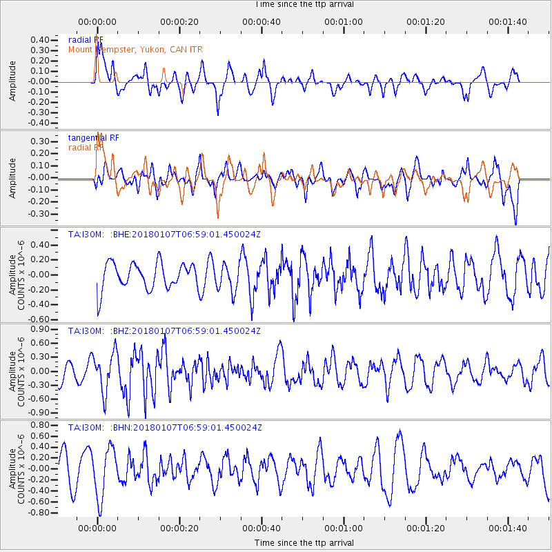
I30M Mount Dempster, Yukon, CAN - Earthquake Result Viewer
*The percent match for this event was below the threshold and hence no stack was calculated.
| Earthquake location: |
Myanmar-India Border Region |
| Earthquake latitude/longitude: |
24.8/94.9 |
| Earthquake time(UTC): |
2018/01/07 (007) 06:47:14 GMT |
| Earthquake Depth: |
23 km |
| Earthquake Magnitude: |
5.5 Mww |
| Earthquake Catalog/Contributor: |
NEIC PDE/us |
|
| Network: |
TA USArray Transportable Network (new EarthScope stations) |
| Station: |
I30M Mount Dempster, Yukon, CAN |
| Lat/Lon: |
65.22 N/136.38 W |
| Elevation: |
1399 m |
|
| Distance: |
82.1 deg |
| Az: |
19.392 deg |
| Baz: |
314.25 deg |
| Ray Param: |
$rayparam |
*The percent match for this event was below the threshold and hence was not used in the summary stack. |
|
| Radial Match: |
63.269173 % |
| Radial Bump: |
400 |
| Transverse Match: |
40.481792 % |
| Transverse Bump: |
400 |
| SOD ConfigId: |
13570011 |
| Insert Time: |
2019-04-29 12:45:20.639 +0000 |
| GWidth: |
2.5 |
| Max Bumps: |
400 |
| Tol: |
0.001 |
|
Signal To Noise
| Channel | StoN | STA | LTA |
| TA:I30M: :BHZ:20180107T06:59:01.450024Z | 1.6470829 | 4.2313482E-7 | 2.5689954E-7 |
| TA:I30M: :BHN:20180107T06:59:01.450024Z | 2.2381902 | 4.633532E-7 | 2.0702136E-7 |
| TA:I30M: :BHE:20180107T06:59:01.450024Z | 1.1015397 | 1.8962868E-7 | 1.7214875E-7 |
| Arrivals |
| Ps | |
| PpPs | |
| PsPs/PpSs | |


