You are here: Home > Network List > US - United States National Seismic Network Stations List
> Station WMOK Wichita Mountains, Oklahoma, USA > Earthquake Result Viewer
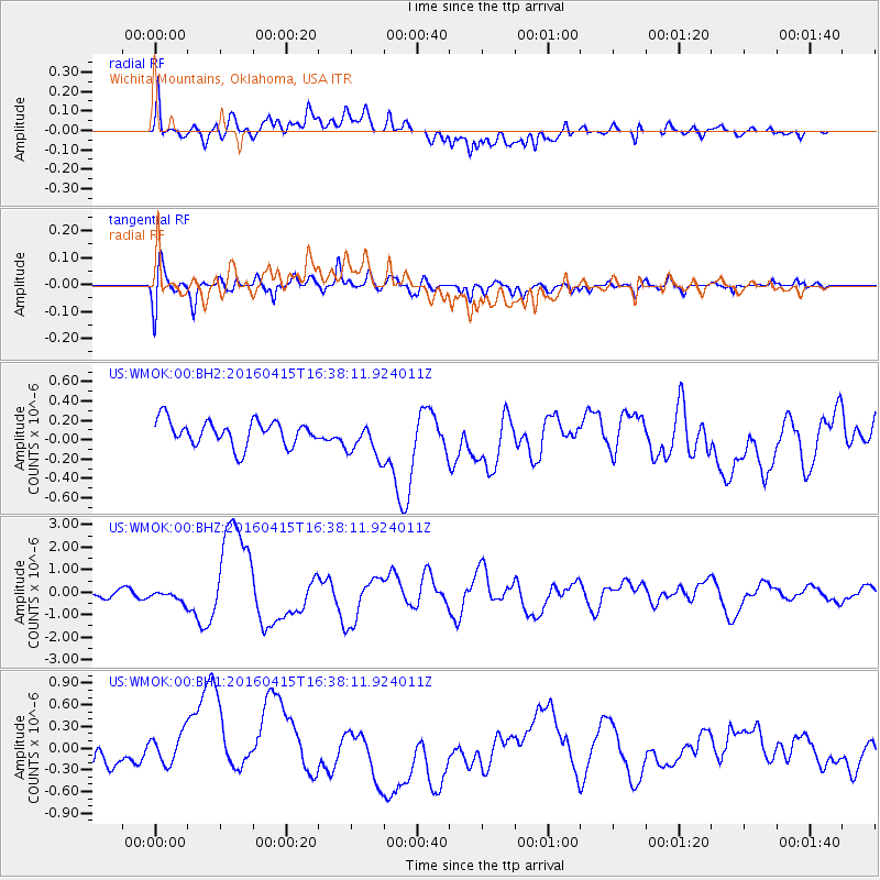
WMOK Wichita Mountains, Oklahoma, USA - Earthquake Result Viewer
*The percent match for this event was below the threshold and hence no stack was calculated.
| Earthquake location: |
Kyushu, Japan |
| Earthquake latitude/longitude: |
32.8/130.7 |
| Earthquake time(UTC): |
2016/04/15 (106) 16:25:06 GMT |
| Earthquake Depth: |
10 km |
| Earthquake Magnitude: |
7.0 MO |
| Earthquake Catalog/Contributor: |
NEIC PDE/NEIC ALERT |
|
| Network: |
US United States National Seismic Network |
| Station: |
WMOK Wichita Mountains, Oklahoma, USA |
| Lat/Lon: |
34.74 N/98.78 W |
| Elevation: |
486 m |
|
| Distance: |
98.3 deg |
| Az: |
39.27 deg |
| Baz: |
319.651 deg |
| Ray Param: |
$rayparam |
*The percent match for this event was below the threshold and hence was not used in the summary stack. |
|
| Radial Match: |
59.220707 % |
| Radial Bump: |
400 |
| Transverse Match: |
74.78053 % |
| Transverse Bump: |
400 |
| SOD ConfigId: |
1475611 |
| Insert Time: |
2016-04-29 16:50:37.030 +0000 |
| GWidth: |
2.5 |
| Max Bumps: |
400 |
| Tol: |
0.001 |
|
Signal To Noise
| Channel | StoN | STA | LTA |
| US:WMOK:00:BHZ:20160415T16:38:11.924011Z | 1.6335934 | 2.299655E-7 | 1.4077277E-7 |
| US:WMOK:00:BH1:20160415T16:38:11.924011Z | 2.017032 | 3.28347E-7 | 1.6278722E-7 |
| US:WMOK:00:BH2:20160415T16:38:11.924011Z | 1.457006 | 1.8885245E-7 | 1.296168E-7 |
| Arrivals |
| Ps | |
| PpPs | |
| PsPs/PpSs | |


