
MSTX Muleshoe, TX, USA - Earthquake Result Viewer
| ||||||||||||||||||
| ||||||||||||||||||
| ||||||||||||||||||
|
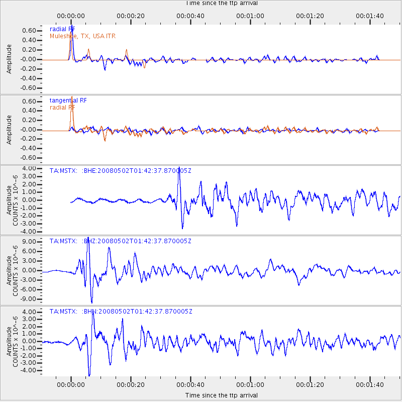
Signal To Noise
| Channel | StoN | STA | LTA |
| TA:MSTX: :BHZ:20080502T01:42:37.870005Z | 13.387936 | 1.8217356E-6 | 1.3607293E-7 |
| TA:MSTX: :BHN:20080502T01:42:37.870005Z | 3.2050729 | 4.7779116E-7 | 1.4907341E-7 |
| TA:MSTX: :BHE:20080502T01:42:37.870005Z | 1.8179127 | 3.004916E-7 | 1.6529484E-7 |
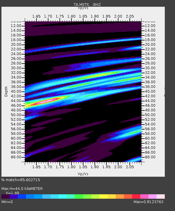
| Arrivals | |
| Ps | 5.2 SECOND |
| PpPs | 18 SECOND |
| PsPs/PpSs | 24 SECOND |

