
MSTX Muleshoe, TX, USA - Earthquake Result Viewer
| ||||||||||||||||||
| ||||||||||||||||||
| ||||||||||||||||||
|
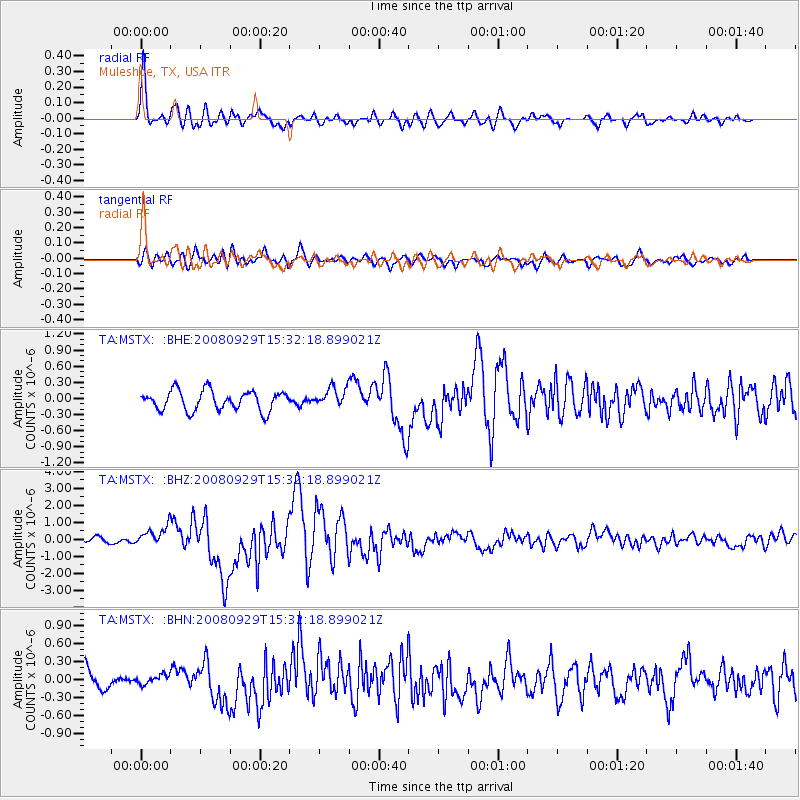
Signal To Noise
| Channel | StoN | STA | LTA |
| TA:MSTX: :BHZ:20080929T15:32:18.899021Z | 3.4219933 | 5.576769E-7 | 1.6296843E-7 |
| TA:MSTX: :BHN:20080929T15:32:18.899021Z | 0.52898216 | 8.053812E-8 | 1.522511E-7 |
| TA:MSTX: :BHE:20080929T15:32:18.899021Z | 0.9747921 | 1.769499E-7 | 1.8152578E-7 |
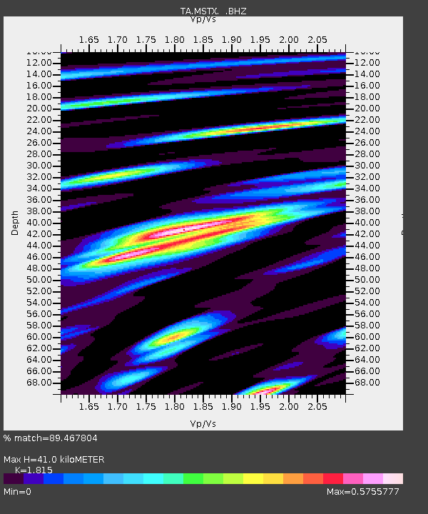
| Arrivals | |
| Ps | 5.5 SECOND |
| PpPs | 19 SECOND |
| PsPs/PpSs | 24 SECOND |

