You are here: Home > Network List > CI - Caltech Regional Seismic Network Stations List
> Station MPP McPhearson Peak > Earthquake Result Viewer
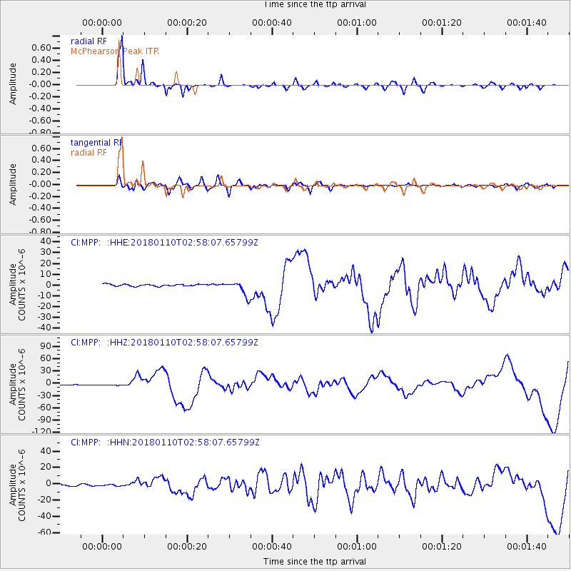
MPP McPhearson Peak - Earthquake Result Viewer
*The percent match for this event was below the threshold and hence no stack was calculated.
| Earthquake location: |
North Of Honduras |
| Earthquake latitude/longitude: |
17.5/-83.6 |
| Earthquake time(UTC): |
2018/01/10 (010) 02:51:31 GMT |
| Earthquake Depth: |
33 km |
| Earthquake Magnitude: |
7.8 Mi |
| Earthquake Catalog/Contributor: |
NEIC PDE/pt |
|
| Network: |
CI Caltech Regional Seismic Network |
| Station: |
MPP McPhearson Peak |
| Lat/Lon: |
34.89 N/119.81 W |
| Elevation: |
1739 m |
|
| Distance: |
36.6 deg |
| Az: |
305.377 deg |
| Baz: |
108.827 deg |
| Ray Param: |
$rayparam |
*The percent match for this event was below the threshold and hence was not used in the summary stack. |
|
| Radial Match: |
92.531876 % |
| Radial Bump: |
330 |
| Transverse Match: |
70.50678 % |
| Transverse Bump: |
400 |
| SOD ConfigId: |
13570011 |
| Insert Time: |
2019-04-29 12:57:39.189 +0000 |
| GWidth: |
2.5 |
| Max Bumps: |
400 |
| Tol: |
0.001 |
|
Signal To Noise
| Channel | StoN | STA | LTA |
| CI:MPP: :HHZ:20180110T02:58:07.65799Z | 1.8945191 | 1.1245385E-6 | 5.935746E-7 |
| CI:MPP: :HHN:20180110T02:58:07.65799Z | 0.9260892 | 9.055151E-7 | 9.777838E-7 |
| CI:MPP: :HHE:20180110T02:58:07.65799Z | 0.94601864 | 8.645343E-7 | 9.13866E-7 |
| Arrivals |
| Ps | |
| PpPs | |
| PsPs/PpSs | |


