You are here: Home > Network List > CI - Caltech Regional Seismic Network Stations List
> Station SMM Simmler, CA, USA > Earthquake Result Viewer
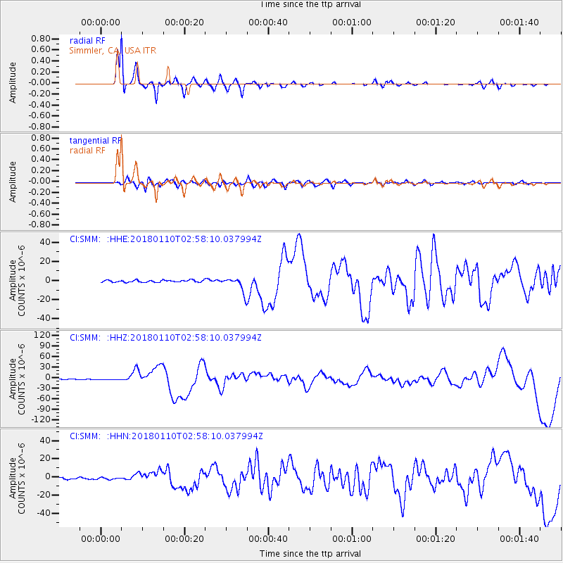
SMM Simmler, CA, USA - Earthquake Result Viewer
*The percent match for this event was below the threshold and hence no stack was calculated.
| Earthquake location: |
North Of Honduras |
| Earthquake latitude/longitude: |
17.5/-83.6 |
| Earthquake time(UTC): |
2018/01/10 (010) 02:51:31 GMT |
| Earthquake Depth: |
33 km |
| Earthquake Magnitude: |
7.8 Mi |
| Earthquake Catalog/Contributor: |
NEIC PDE/pt |
|
| Network: |
CI Caltech Regional Seismic Network |
| Station: |
SMM Simmler, CA, USA |
| Lat/Lon: |
35.31 N/120.00 W |
| Elevation: |
599 m |
|
| Distance: |
36.9 deg |
| Az: |
305.967 deg |
| Baz: |
109.196 deg |
| Ray Param: |
$rayparam |
*The percent match for this event was below the threshold and hence was not used in the summary stack. |
|
| Radial Match: |
92.381485 % |
| Radial Bump: |
288 |
| Transverse Match: |
59.146862 % |
| Transverse Bump: |
400 |
| SOD ConfigId: |
13570011 |
| Insert Time: |
2019-04-29 12:57:50.994 +0000 |
| GWidth: |
2.5 |
| Max Bumps: |
400 |
| Tol: |
0.001 |
|
Signal To Noise
| Channel | StoN | STA | LTA |
| CI:SMM: :HHZ:20180110T02:58:10.037994Z | 2.2778485 | 1.2731507E-6 | 5.5892684E-7 |
| CI:SMM: :HHN:20180110T02:58:10.037994Z | 0.8642721 | 9.838013E-7 | 1.1383004E-6 |
| CI:SMM: :HHE:20180110T02:58:10.037994Z | 1.6127717 | 1.5578411E-6 | 9.659402E-7 |
| Arrivals |
| Ps | |
| PpPs | |
| PsPs/PpSs | |


