You are here: Home > Network List > GS - US Geological Survey Networks Stations List
> Station OK039 N2440 and E0440 Rds, Cleo Springs, OK, USA > Earthquake Result Viewer
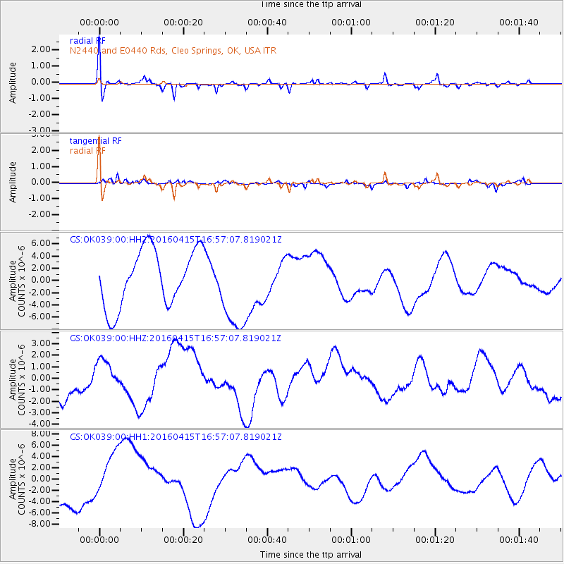
OK039 N2440 and E0440 Rds, Cleo Springs, OK, USA - Earthquake Result Viewer
*The percent match for this event was below the threshold and hence no stack was calculated.
| Earthquake location: |
Kyushu, Japan |
| Earthquake latitude/longitude: |
32.7/130.7 |
| Earthquake time(UTC): |
2016/04/15 (106) 16:44:06 GMT |
| Earthquake Depth: |
10 km |
| Earthquake Magnitude: |
5.8 MB |
| Earthquake Catalog/Contributor: |
NEIC PDE/NEIC COMCAT |
|
| Network: |
GS US Geological Survey Networks |
| Station: |
OK039 N2440 and E0440 Rds, Cleo Springs, OK, USA |
| Lat/Lon: |
36.38 N/98.65 W |
| Elevation: |
400 m |
|
| Distance: |
97.2 deg |
| Az: |
38.103 deg |
| Baz: |
319.848 deg |
| Ray Param: |
$rayparam |
*The percent match for this event was below the threshold and hence was not used in the summary stack. |
|
| Radial Match: |
48.079323 % |
| Radial Bump: |
364 |
| Transverse Match: |
61.436035 % |
| Transverse Bump: |
350 |
| SOD ConfigId: |
1475611 |
| Insert Time: |
2016-04-29 17:01:15.062 +0000 |
| GWidth: |
2.5 |
| Max Bumps: |
400 |
| Tol: |
0.001 |
|
Signal To Noise
| Channel | StoN | STA | LTA |
| GS:OK039:00:HHZ:20160415T16:57:07.819021Z | 0.7724259 | 1.5109796E-6 | 1.9561483E-6 |
| GS:OK039:00:HH1:20160415T16:57:07.819021Z | 0.7923252 | 3.6518363E-6 | 4.6090117E-6 |
| GS:OK039:00:HH2:20160415T16:57:07.819021Z | 1.5328301 | 7.074151E-6 | 4.6150917E-6 |
| Arrivals |
| Ps | |
| PpPs | |
| PsPs/PpSs | |


