You are here: Home > Network List > TA - USArray Transportable Network (new EarthScope stations) Stations List
> Station MSTX Muleshoe, TX, USA > Earthquake Result Viewer
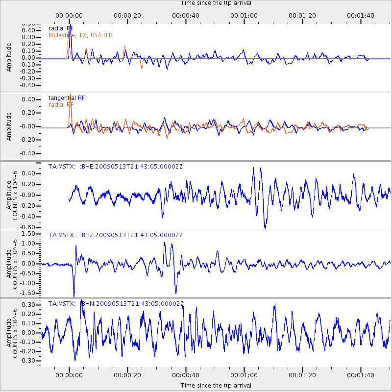
MSTX Muleshoe, TX, USA - Earthquake Result Viewer
*The percent match for this event was below the threshold and hence no stack was calculated.
| Earthquake location: |
Tonga Islands |
| Earthquake latitude/longitude: |
-15.8/-173.5 |
| Earthquake time(UTC): |
2009/05/13 (133) 21:31:17 GMT |
| Earthquake Depth: |
85 km |
| Earthquake Magnitude: |
5.8 MW, 5.3 MB, 5.8 MW |
| Earthquake Catalog/Contributor: |
WHDF/NEIC |
|
| Network: |
TA USArray Transportable Network (new EarthScope stations) |
| Station: |
MSTX Muleshoe, TX, USA |
| Lat/Lon: |
33.97 N/102.77 W |
| Elevation: |
1167 m |
|
| Distance: |
83.4 deg |
| Az: |
52.15 deg |
| Baz: |
246.192 deg |
| Ray Param: |
$rayparam |
*The percent match for this event was below the threshold and hence was not used in the summary stack. |
|
| Radial Match: |
68.34903 % |
| Radial Bump: |
400 |
| Transverse Match: |
57.406647 % |
| Transverse Bump: |
393 |
| SOD ConfigId: |
2760 |
| Insert Time: |
2010-03-06 07:47:08.714 +0000 |
| GWidth: |
2.5 |
| Max Bumps: |
400 |
| Tol: |
0.001 |
|
Signal To Noise
| Channel | StoN | STA | LTA |
| TA:MSTX: :BHZ:20090513T21:43:05.00002Z | 6.3975506 | 5.231208E-7 | 8.176892E-8 |
| TA:MSTX: :BHN:20090513T21:43:05.00002Z | 2.8996875 | 1.8724806E-7 | 6.457526E-8 |
| TA:MSTX: :BHE:20090513T21:43:05.00002Z | 1.8791256 | 1.573888E-7 | 8.37564E-8 |
| Arrivals |
| Ps | |
| PpPs | |
| PsPs/PpSs | |


