You are here: Home > Network List > TA - USArray Transportable Network (new EarthScope stations) Stations List
> Station MSTX Muleshoe, TX, USA > Earthquake Result Viewer
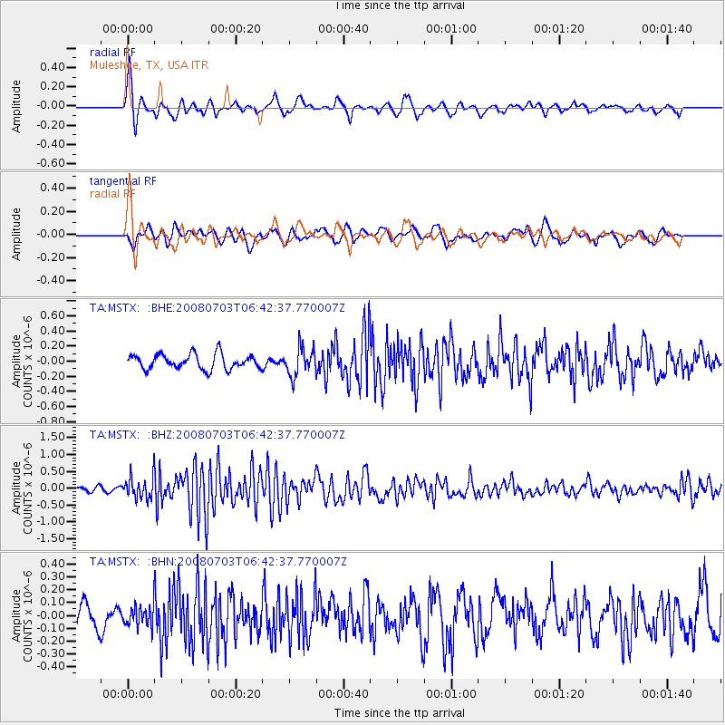
MSTX Muleshoe, TX, USA - Earthquake Result Viewer
*The percent match for this event was below the threshold and hence no stack was calculated.
| Earthquake location: |
Trinidad |
| Earthquake latitude/longitude: |
10.3/-60.4 |
| Earthquake time(UTC): |
2008/07/03 (185) 06:34:53 GMT |
| Earthquake Depth: |
34 km |
| Earthquake Magnitude: |
5.7 MB, 5.5 MS, 5.8 MW, 5.7 MW |
| Earthquake Catalog/Contributor: |
WHDF/NEIC |
|
| Network: |
TA USArray Transportable Network (new EarthScope stations) |
| Station: |
MSTX Muleshoe, TX, USA |
| Lat/Lon: |
33.97 N/102.77 W |
| Elevation: |
1167 m |
|
| Distance: |
45.3 deg |
| Az: |
308.075 deg |
| Baz: |
111.217 deg |
| Ray Param: |
$rayparam |
*The percent match for this event was below the threshold and hence was not used in the summary stack. |
|
| Radial Match: |
64.4592 % |
| Radial Bump: |
371 |
| Transverse Match: |
63.02889 % |
| Transverse Bump: |
400 |
| SOD ConfigId: |
2504 |
| Insert Time: |
2010-03-06 07:47:32.694 +0000 |
| GWidth: |
2.5 |
| Max Bumps: |
400 |
| Tol: |
0.001 |
|
Signal To Noise
| Channel | StoN | STA | LTA |
| TA:MSTX: :BHZ:20080703T06:42:37.770007Z | 4.91082 | 3.238074E-7 | 6.593754E-8 |
| TA:MSTX: :BHN:20080703T06:42:37.770007Z | 0.9148361 | 7.8039115E-8 | 8.530394E-8 |
| TA:MSTX: :BHE:20080703T06:42:37.770007Z | 1.9139736 | 1.8697023E-7 | 9.768694E-8 |
| Arrivals |
| Ps | |
| PpPs | |
| PsPs/PpSs | |


