You are here: Home > Network List > TA - USArray Transportable Network (new EarthScope stations) Stations List
> Station A36M Sachs Harbour, NT, CAN > Earthquake Result Viewer
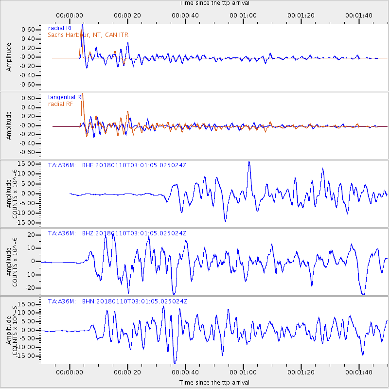
A36M Sachs Harbour, NT, CAN - Earthquake Result Viewer
*The percent match for this event was below the threshold and hence no stack was calculated.
| Earthquake location: |
North Of Honduras |
| Earthquake latitude/longitude: |
17.5/-83.6 |
| Earthquake time(UTC): |
2018/01/10 (010) 02:51:31 GMT |
| Earthquake Depth: |
33 km |
| Earthquake Magnitude: |
7.8 Mi |
| Earthquake Catalog/Contributor: |
NEIC PDE/pt |
|
| Network: |
TA USArray Transportable Network (new EarthScope stations) |
| Station: |
A36M Sachs Harbour, NT, CAN |
| Lat/Lon: |
71.99 N/125.25 W |
| Elevation: |
32 m |
|
| Distance: |
59.6 deg |
| Az: |
346.122 deg |
| Baz: |
132.632 deg |
| Ray Param: |
$rayparam |
*The percent match for this event was below the threshold and hence was not used in the summary stack. |
|
| Radial Match: |
97.44164 % |
| Radial Bump: |
400 |
| Transverse Match: |
89.394485 % |
| Transverse Bump: |
400 |
| SOD ConfigId: |
13570011 |
| Insert Time: |
2019-04-29 13:01:40.677 +0000 |
| GWidth: |
2.5 |
| Max Bumps: |
400 |
| Tol: |
0.001 |
|
Signal To Noise
| Channel | StoN | STA | LTA |
| TA:A36M: :BHZ:20180110T03:01:05.025024Z | 1.5905753 | 3.2541416E-7 | 2.0458897E-7 |
| TA:A36M: :BHN:20180110T03:01:05.025024Z | 0.9063138 | 2.2904328E-7 | 2.5271964E-7 |
| TA:A36M: :BHE:20180110T03:01:05.025024Z | 1.5036616 | 3.5010595E-7 | 2.328356E-7 |
| Arrivals |
| Ps | |
| PpPs | |
| PsPs/PpSs | |


