You are here: Home > Network List > TA - USArray Transportable Network (new EarthScope stations) Stations List
> Station MSTX Muleshoe, TX, USA > Earthquake Result Viewer
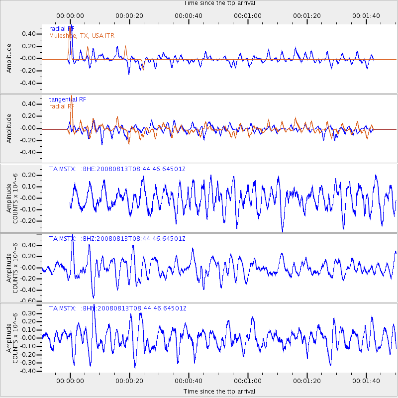
MSTX Muleshoe, TX, USA - Earthquake Result Viewer
*The percent match for this event was below the threshold and hence no stack was calculated.
| Earthquake location: |
North Of Severnaya Zemlya |
| Earthquake latitude/longitude: |
83.6/115.2 |
| Earthquake time(UTC): |
2008/08/13 (226) 08:35:02 GMT |
| Earthquake Depth: |
10 km |
| Earthquake Magnitude: |
5.5 MB, 4.7 MS, 5.4 MW, 5.4 MW |
| Earthquake Catalog/Contributor: |
WHDF/NEIC |
|
| Network: |
TA USArray Transportable Network (new EarthScope stations) |
| Station: |
MSTX Muleshoe, TX, USA |
| Lat/Lon: |
33.97 N/102.77 W |
| Elevation: |
1167 m |
|
| Distance: |
61.3 deg |
| Az: |
35.687 deg |
| Baz: |
355.511 deg |
| Ray Param: |
$rayparam |
*The percent match for this event was below the threshold and hence was not used in the summary stack. |
|
| Radial Match: |
55.87404 % |
| Radial Bump: |
400 |
| Transverse Match: |
62.88872 % |
| Transverse Bump: |
400 |
| SOD ConfigId: |
2504 |
| Insert Time: |
2010-03-06 07:47:43.336 +0000 |
| GWidth: |
2.5 |
| Max Bumps: |
400 |
| Tol: |
0.001 |
|
Signal To Noise
| Channel | StoN | STA | LTA |
| TA:MSTX: :BHZ:20080813T08:44:46.64501Z | 2.5702906 | 2.0147752E-7 | 7.838706E-8 |
| TA:MSTX: :BHN:20080813T08:44:46.64501Z | 1.6796103 | 1.36086E-7 | 8.1022364E-8 |
| TA:MSTX: :BHE:20080813T08:44:46.64501Z | 0.7879157 | 5.9101357E-8 | 7.5009744E-8 |
| Arrivals |
| Ps | |
| PpPs | |
| PsPs/PpSs | |


