You are here: Home > Network List > TA - USArray Transportable Network (new EarthScope stations) Stations List
> Station D25K Kavik River, AK, USA > Earthquake Result Viewer
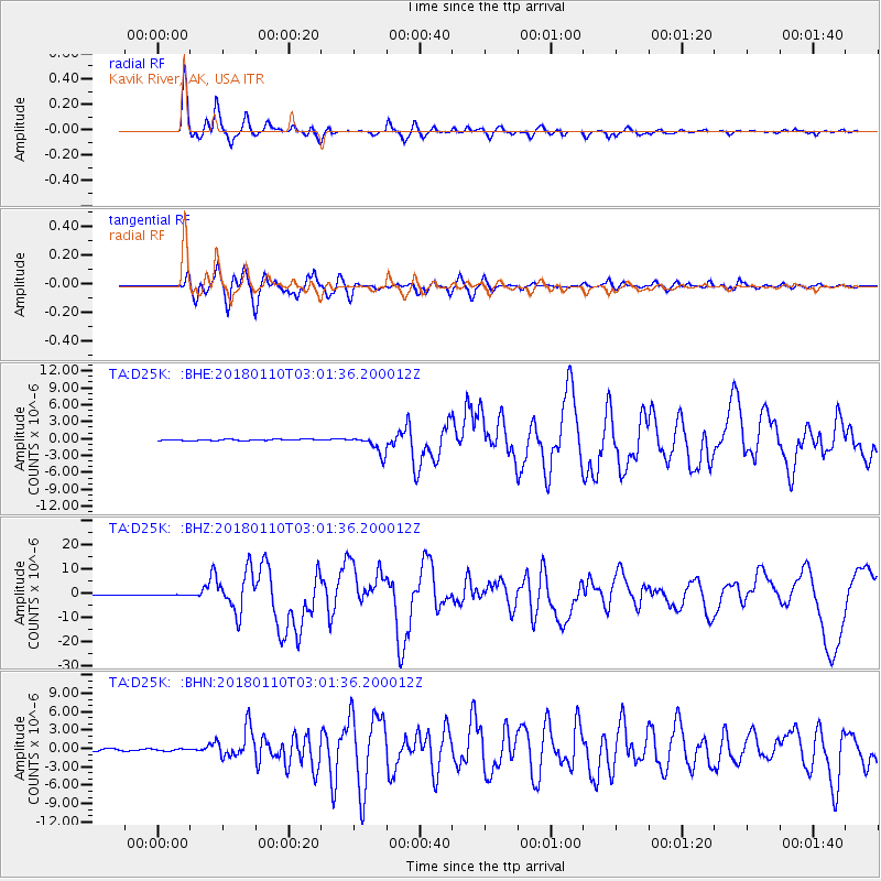
D25K Kavik River, AK, USA - Earthquake Result Viewer
*The percent match for this event was below the threshold and hence no stack was calculated.
| Earthquake location: |
North Of Honduras |
| Earthquake latitude/longitude: |
17.5/-83.6 |
| Earthquake time(UTC): |
2018/01/10 (010) 02:51:31 GMT |
| Earthquake Depth: |
33 km |
| Earthquake Magnitude: |
7.8 Mi |
| Earthquake Catalog/Contributor: |
NEIC PDE/pt |
|
| Network: |
TA USArray Transportable Network (new EarthScope stations) |
| Station: |
D25K Kavik River, AK, USA |
| Lat/Lon: |
69.32 N/146.38 W |
| Elevation: |
770 m |
|
| Distance: |
64.3 deg |
| Az: |
339.466 deg |
| Baz: |
109.545 deg |
| Ray Param: |
$rayparam |
*The percent match for this event was below the threshold and hence was not used in the summary stack. |
|
| Radial Match: |
93.9526 % |
| Radial Bump: |
400 |
| Transverse Match: |
92.744255 % |
| Transverse Bump: |
400 |
| SOD ConfigId: |
13570011 |
| Insert Time: |
2019-04-29 13:01:55.135 +0000 |
| GWidth: |
2.5 |
| Max Bumps: |
400 |
| Tol: |
0.001 |
|
Signal To Noise
| Channel | StoN | STA | LTA |
| TA:D25K: :BHZ:20180110T03:01:36.200012Z | 1.602861 | 1.437854E-7 | 8.9705466E-8 |
| TA:D25K: :BHN:20180110T03:01:36.200012Z | 0.77435327 | 1.4665719E-7 | 1.8939312E-7 |
| TA:D25K: :BHE:20180110T03:01:36.200012Z | 1.4366928 | 1.6150398E-7 | 1.1241371E-7 |
| Arrivals |
| Ps | |
| PpPs | |
| PsPs/PpSs | |


