You are here: Home > Network List > TA - USArray Transportable Network (new EarthScope stations) Stations List
> Station G21K Allakaket, AK, USA > Earthquake Result Viewer
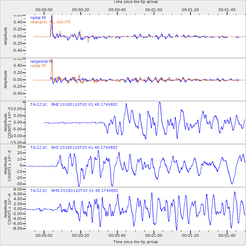
G21K Allakaket, AK, USA - Earthquake Result Viewer
*The percent match for this event was below the threshold and hence no stack was calculated.
| Earthquake location: |
North Of Honduras |
| Earthquake latitude/longitude: |
17.5/-83.6 |
| Earthquake time(UTC): |
2018/01/10 (010) 02:51:31 GMT |
| Earthquake Depth: |
33 km |
| Earthquake Magnitude: |
7.8 Mi |
| Earthquake Catalog/Contributor: |
NEIC PDE/pt |
|
| Network: |
TA USArray Transportable Network (new EarthScope stations) |
| Station: |
G21K Allakaket, AK, USA |
| Lat/Lon: |
66.52 N/153.51 W |
| Elevation: |
446 m |
|
| Distance: |
66.1 deg |
| Az: |
335.686 deg |
| Baz: |
101.353 deg |
| Ray Param: |
$rayparam |
*The percent match for this event was below the threshold and hence was not used in the summary stack. |
|
| Radial Match: |
96.949905 % |
| Radial Bump: |
333 |
| Transverse Match: |
91.234314 % |
| Transverse Bump: |
400 |
| SOD ConfigId: |
13570011 |
| Insert Time: |
2019-04-29 13:02:17.330 +0000 |
| GWidth: |
2.5 |
| Max Bumps: |
400 |
| Tol: |
0.001 |
|
Signal To Noise
| Channel | StoN | STA | LTA |
| TA:G21K: :BHZ:20180110T03:01:48.174988Z | 1.8434727 | 3.419301E-7 | 1.854815E-7 |
| TA:G21K: :BHN:20180110T03:01:48.174988Z | 1.3046168 | 2.0652749E-7 | 1.583051E-7 |
| TA:G21K: :BHE:20180110T03:01:48.174988Z | 1.4765704 | 2.8035615E-7 | 1.8986981E-7 |
| Arrivals |
| Ps | |
| PpPs | |
| PsPs/PpSs | |


