You are here: Home > Network List > TA - USArray Transportable Network (new EarthScope stations) Stations List
> Station G23K Bananza Creek, AK, USA > Earthquake Result Viewer
G23K Bananza Creek, AK, USA - Earthquake Result Viewer
*The percent match for this event was below the threshold and hence no stack was calculated.
| Earthquake location: |
North Of Honduras |
| Earthquake latitude/longitude: |
17.5/-83.6 |
| Earthquake time(UTC): |
2018/01/10 (010) 02:51:31 GMT |
| Earthquake Depth: |
33 km |
| Earthquake Magnitude: |
7.8 Mi |
| Earthquake Catalog/Contributor: |
NEIC PDE/pt |
|
| Network: |
TA USArray Transportable Network (new EarthScope stations) |
| Station: |
G23K Bananza Creek, AK, USA |
| Lat/Lon: |
66.71 N/150.02 W |
| Elevation: |
746 m |
|
| Distance: |
64.8 deg |
| Az: |
336.241 deg |
| Baz: |
104.776 deg |
| Ray Param: |
$rayparam |
*The percent match for this event was below the threshold and hence was not used in the summary stack. |
|
| Radial Match: |
96.864105 % |
| Radial Bump: |
289 |
| Transverse Match: |
85.685974 % |
| Transverse Bump: |
400 |
| SOD ConfigId: |
13570011 |
| Insert Time: |
2019-04-29 13:02:17.778 +0000 |
| GWidth: |
2.5 |
| Max Bumps: |
400 |
| Tol: |
0.001 |
|
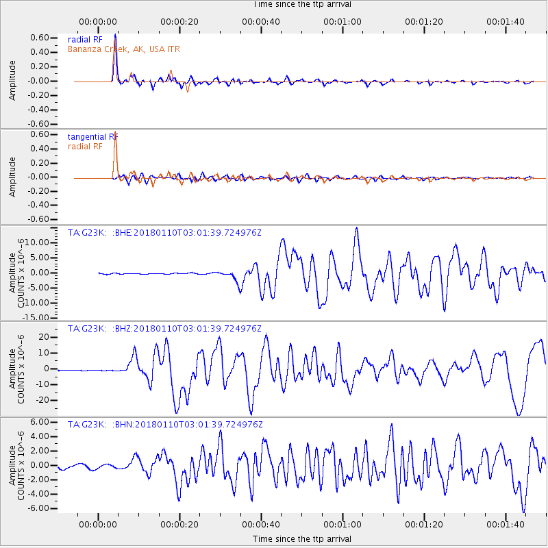
Signal To Noise
| Channel | StoN | STA | LTA |
| TA:G23K: :BHZ:20180110T03:01:39.724976Z | 2.6614118 | 2.4555203E-7 | 9.2263825E-8 |
| TA:G23K: :BHN:20180110T03:01:39.724976Z | 1.2149013 | 2.7979837E-7 | 2.3030543E-7 |
| TA:G23K: :BHE:20180110T03:01:39.724976Z | 2.302681 | 2.8655583E-7 | 1.2444444E-7 |
| Arrivals |
| Ps | |
| PpPs | |
| PsPs/PpSs | |


