You are here: Home > Network List > TA - USArray Transportable Network (new EarthScope stations) Stations List
> Station G31M Satah River, YT, CAN > Earthquake Result Viewer
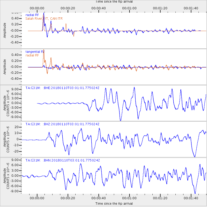
G31M Satah River, YT, CAN - Earthquake Result Viewer
*The percent match for this event was below the threshold and hence no stack was calculated.
| Earthquake location: |
North Of Honduras |
| Earthquake latitude/longitude: |
17.5/-83.6 |
| Earthquake time(UTC): |
2018/01/10 (010) 02:51:31 GMT |
| Earthquake Depth: |
33 km |
| Earthquake Magnitude: |
7.8 Mi |
| Earthquake Catalog/Contributor: |
NEIC PDE/pt |
|
| Network: |
TA USArray Transportable Network (new EarthScope stations) |
| Station: |
G31M Satah River, YT, CAN |
| Lat/Lon: |
66.92 N/134.27 W |
| Elevation: |
61 m |
|
| Distance: |
59.1 deg |
| Az: |
339.181 deg |
| Baz: |
120.64 deg |
| Ray Param: |
$rayparam |
*The percent match for this event was below the threshold and hence was not used in the summary stack. |
|
| Radial Match: |
95.38171 % |
| Radial Bump: |
357 |
| Transverse Match: |
78.41213 % |
| Transverse Bump: |
400 |
| SOD ConfigId: |
13570011 |
| Insert Time: |
2019-04-29 13:02:23.103 +0000 |
| GWidth: |
2.5 |
| Max Bumps: |
400 |
| Tol: |
0.001 |
|
Signal To Noise
| Channel | StoN | STA | LTA |
| TA:G31M: :BHZ:20180110T03:01:01.775024Z | 1.0191772 | 2.2776068E-7 | 2.2347507E-7 |
| TA:G31M: :BHN:20180110T03:01:01.775024Z | 0.57198715 | 2.0188301E-7 | 3.5295028E-7 |
| TA:G31M: :BHE:20180110T03:01:01.775024Z | 1.1664668 | 3.0300652E-7 | 2.5976433E-7 |
| Arrivals |
| Ps | |
| PpPs | |
| PsPs/PpSs | |


