You are here: Home > Network List > TA - USArray Transportable Network (new EarthScope stations) Stations List
> Station L15K Ungalak Mountain, AK, USA > Earthquake Result Viewer
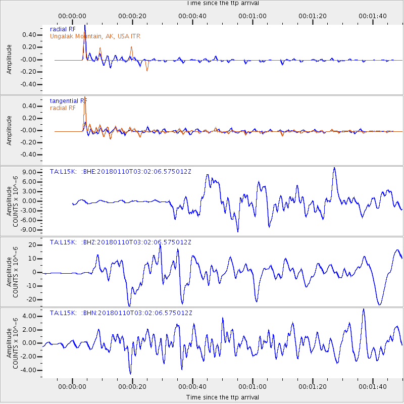
L15K Ungalak Mountain, AK, USA - Earthquake Result Viewer
*The percent match for this event was below the threshold and hence no stack was calculated.
| Earthquake location: |
North Of Honduras |
| Earthquake latitude/longitude: |
17.5/-83.6 |
| Earthquake time(UTC): |
2018/01/10 (010) 02:51:31 GMT |
| Earthquake Depth: |
33 km |
| Earthquake Magnitude: |
7.8 Mi |
| Earthquake Catalog/Contributor: |
NEIC PDE/pt |
|
| Network: |
TA USArray Transportable Network (new EarthScope stations) |
| Station: |
L15K Ungalak Mountain, AK, USA |
| Lat/Lon: |
61.68 N/161.49 W |
| Elevation: |
219 m |
|
| Distance: |
69.0 deg |
| Az: |
330.037 deg |
| Baz: |
92.017 deg |
| Ray Param: |
$rayparam |
*The percent match for this event was below the threshold and hence was not used in the summary stack. |
|
| Radial Match: |
98.09226 % |
| Radial Bump: |
225 |
| Transverse Match: |
87.52316 % |
| Transverse Bump: |
400 |
| SOD ConfigId: |
13570011 |
| Insert Time: |
2019-04-29 13:02:49.872 +0000 |
| GWidth: |
2.5 |
| Max Bumps: |
400 |
| Tol: |
0.001 |
|
Signal To Noise
| Channel | StoN | STA | LTA |
| TA:L15K: :BHZ:20180110T03:02:06.575012Z | 1.3442808 | 4.5581896E-7 | 3.3908017E-7 |
| TA:L15K: :BHN:20180110T03:02:06.575012Z | 1.1848474 | 3.4427163E-7 | 2.9056199E-7 |
| TA:L15K: :BHE:20180110T03:02:06.575012Z | 0.7228221 | 2.7029392E-7 | 3.7394253E-7 |
| Arrivals |
| Ps | |
| PpPs | |
| PsPs/PpSs | |


