You are here: Home > Network List > IU - Global Seismograph Network (GSN - IRIS/USGS) Stations List
> Station FURI Mt. Furi, Ethiopia > Earthquake Result Viewer
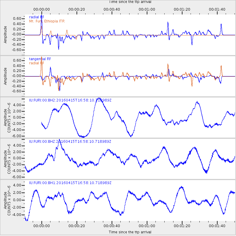
FURI Mt. Furi, Ethiopia - Earthquake Result Viewer
*The percent match for this event was below the threshold and hence no stack was calculated.
| Earthquake location: |
Kyushu, Japan |
| Earthquake latitude/longitude: |
32.9/130.8 |
| Earthquake time(UTC): |
2016/04/15 (106) 16:45:56 GMT |
| Earthquake Depth: |
10 km |
| Earthquake Magnitude: |
5.7 MB |
| Earthquake Catalog/Contributor: |
NEIC PDE/NEIC COMCAT |
|
| Network: |
IU Global Seismograph Network (GSN - IRIS/USGS) |
| Station: |
FURI Mt. Furi, Ethiopia |
| Lat/Lon: |
8.90 N/38.68 E |
| Elevation: |
2570 m |
|
| Distance: |
87.0 deg |
| Az: |
278.606 deg |
| Baz: |
57.35 deg |
| Ray Param: |
$rayparam |
*The percent match for this event was below the threshold and hence was not used in the summary stack. |
|
| Radial Match: |
64.356804 % |
| Radial Bump: |
400 |
| Transverse Match: |
70.72945 % |
| Transverse Bump: |
276 |
| SOD ConfigId: |
1475611 |
| Insert Time: |
2016-04-29 17:22:17.150 +0000 |
| GWidth: |
2.5 |
| Max Bumps: |
400 |
| Tol: |
0.001 |
|
Signal To Noise
| Channel | StoN | STA | LTA |
| IU:FURI:00:BHZ:20160415T16:58:10.718989Z | 0.64711756 | 1.4050602E-6 | 2.1712597E-6 |
| IU:FURI:00:BH1:20160415T16:58:10.718989Z | 0.39666224 | 1.0273881E-6 | 2.5900829E-6 |
| IU:FURI:00:BH2:20160415T16:58:10.718989Z | 1.5008391 | 5.449179E-6 | 3.630755E-6 |
| Arrivals |
| Ps | |
| PpPs | |
| PsPs/PpSs | |


