You are here: Home > Network List > UW - Pacific Northwest Regional Seismic Network Stations List
> Station LEBA Lebam, WA, USA > Earthquake Result Viewer
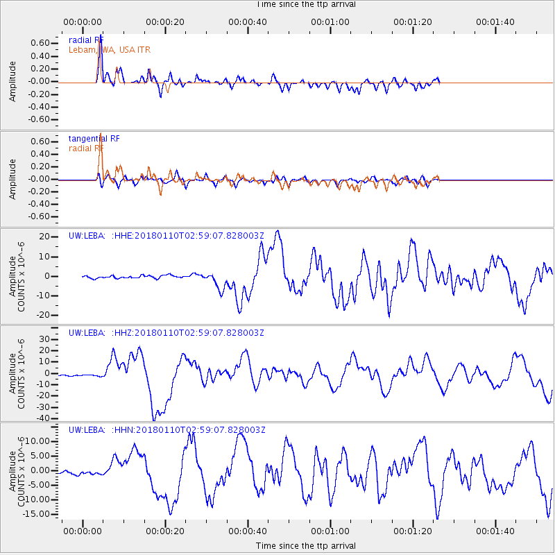
LEBA Lebam, WA, USA - Earthquake Result Viewer
*The percent match for this event was below the threshold and hence no stack was calculated.
| Earthquake location: |
North Of Honduras |
| Earthquake latitude/longitude: |
17.5/-83.6 |
| Earthquake time(UTC): |
2018/01/10 (010) 02:51:31 GMT |
| Earthquake Depth: |
33 km |
| Earthquake Magnitude: |
7.8 Mi |
| Earthquake Catalog/Contributor: |
NEIC PDE/pt |
|
| Network: |
UW Pacific Northwest Regional Seismic Network |
| Station: |
LEBA Lebam, WA, USA |
| Lat/Lon: |
46.55 N/123.56 W |
| Elevation: |
73 m |
|
| Distance: |
43.9 deg |
| Az: |
320.197 deg |
| Baz: |
117.74 deg |
| Ray Param: |
$rayparam |
*The percent match for this event was below the threshold and hence was not used in the summary stack. |
|
| Radial Match: |
84.980965 % |
| Radial Bump: |
400 |
| Transverse Match: |
70.02646 % |
| Transverse Bump: |
400 |
| SOD ConfigId: |
13570011 |
| Insert Time: |
2019-04-29 13:04:27.029 +0000 |
| GWidth: |
2.5 |
| Max Bumps: |
400 |
| Tol: |
0.001 |
|
Signal To Noise
| Channel | StoN | STA | LTA |
| UW:LEBA: :HHZ:20180110T02:59:07.828003Z | 1.5510987 | 1.2530248E-6 | 8.078304E-7 |
| UW:LEBA: :HHN:20180110T02:59:07.828003Z | 1.0706042 | 6.264203E-7 | 5.851091E-7 |
| UW:LEBA: :HHE:20180110T02:59:07.828003Z | 1.5800192 | 1.0945955E-6 | 6.9277354E-7 |
| Arrivals |
| Ps | |
| PpPs | |
| PsPs/PpSs | |


