You are here: Home > Network List > UW - Pacific Northwest Regional Seismic Network Stations List
> Station UMAT Pilot Rock, OR, USA > Earthquake Result Viewer
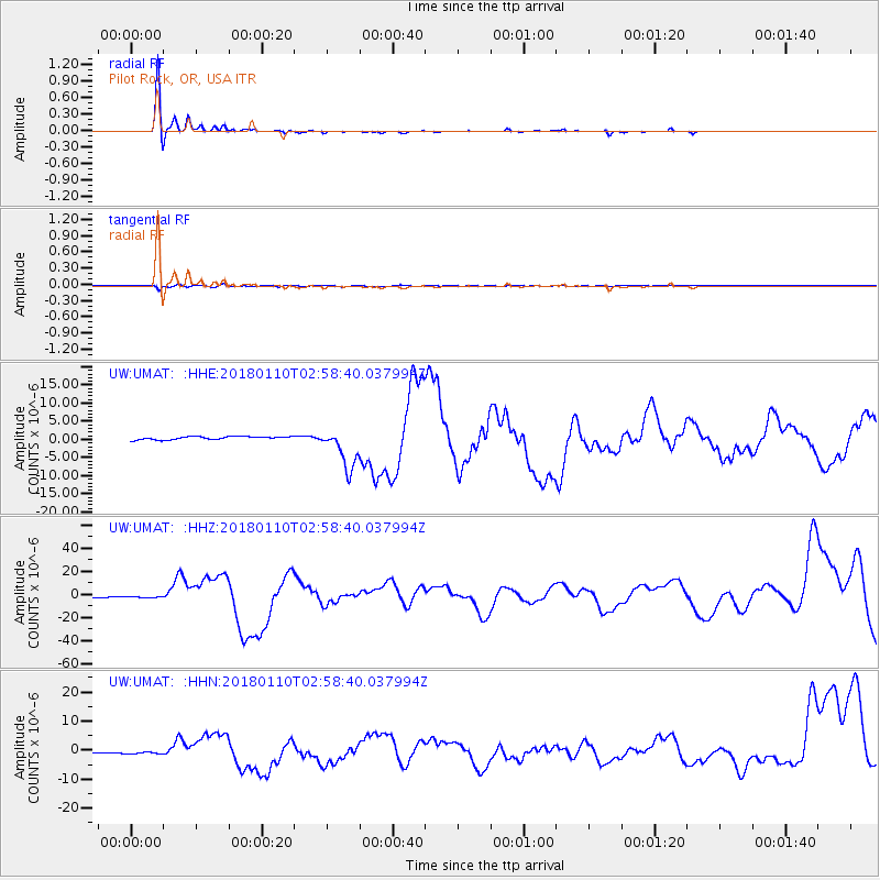
UMAT Pilot Rock, OR, USA - Earthquake Result Viewer
*The percent match for this event was below the threshold and hence no stack was calculated.
| Earthquake location: |
North Of Honduras |
| Earthquake latitude/longitude: |
17.5/-83.6 |
| Earthquake time(UTC): |
2018/01/10 (010) 02:51:31 GMT |
| Earthquake Depth: |
33 km |
| Earthquake Magnitude: |
7.8 Mi |
| Earthquake Catalog/Contributor: |
NEIC PDE/pt |
|
| Network: |
UW Pacific Northwest Regional Seismic Network |
| Station: |
UMAT Pilot Rock, OR, USA |
| Lat/Lon: |
45.29 N/118.96 W |
| Elevation: |
1318 m |
|
| Distance: |
40.5 deg |
| Az: |
320.941 deg |
| Baz: |
121.589 deg |
| Ray Param: |
$rayparam |
*The percent match for this event was below the threshold and hence was not used in the summary stack. |
|
| Radial Match: |
96.287735 % |
| Radial Bump: |
242 |
| Transverse Match: |
69.08524 % |
| Transverse Bump: |
400 |
| SOD ConfigId: |
13570011 |
| Insert Time: |
2019-04-29 13:04:39.821 +0000 |
| GWidth: |
2.5 |
| Max Bumps: |
400 |
| Tol: |
0.001 |
|
Signal To Noise
| Channel | StoN | STA | LTA |
| UW:UMAT: :HHZ:20180110T02:58:40.037994Z | 1.0897928 | 4.434602E-7 | 4.0692157E-7 |
| UW:UMAT: :HHN:20180110T02:58:40.037994Z | 1.2337705 | 3.2728624E-7 | 2.652732E-7 |
| UW:UMAT: :HHE:20180110T02:58:40.037994Z | 1.0800242 | 5.031334E-7 | 4.6585376E-7 |
| Arrivals |
| Ps | |
| PpPs | |
| PsPs/PpSs | |


