You are here: Home > Network List > TA - USArray Transportable Network (new EarthScope stations) Stations List
> Station MSTX Muleshoe, TX, USA > Earthquake Result Viewer
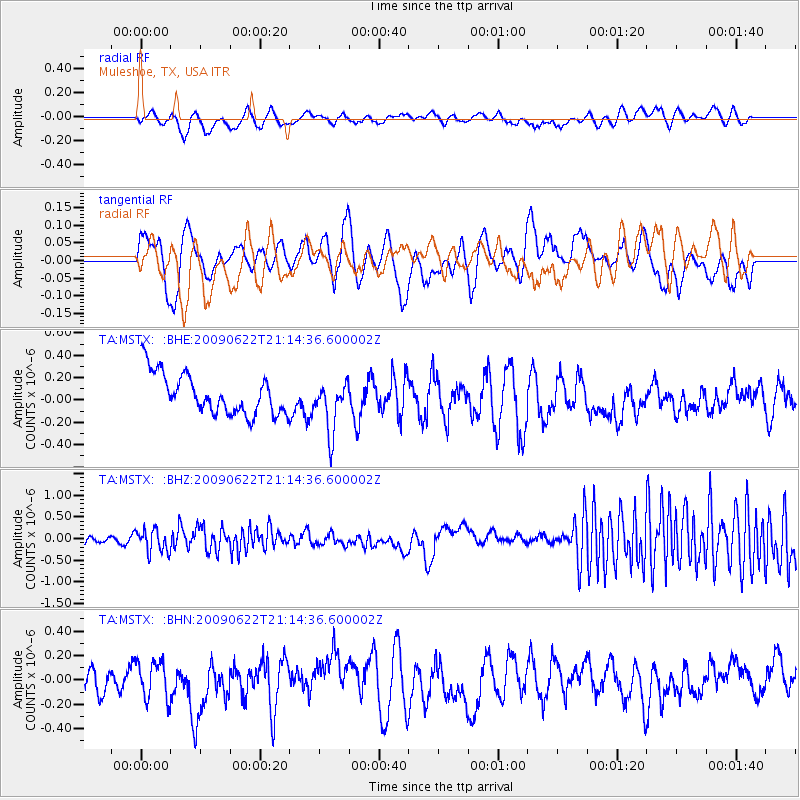
MSTX Muleshoe, TX, USA - Earthquake Result Viewer
*The percent match for this event was below the threshold and hence no stack was calculated.
| Earthquake location: |
Andreanof Islands, Aleutian Is. |
| Earthquake latitude/longitude: |
51.3/-178.2 |
| Earthquake time(UTC): |
2009/06/22 (173) 21:05:33 GMT |
| Earthquake Depth: |
29 km |
| Earthquake Magnitude: |
5.5 MB, 5.0 MS, 5.4 MW, 5.4 MW |
| Earthquake Catalog/Contributor: |
WHDF/NEIC |
|
| Network: |
TA USArray Transportable Network (new EarthScope stations) |
| Station: |
MSTX Muleshoe, TX, USA |
| Lat/Lon: |
33.97 N/102.77 W |
| Elevation: |
1167 m |
|
| Distance: |
55.7 deg |
| Az: |
76.95 deg |
| Baz: |
312.679 deg |
| Ray Param: |
$rayparam |
*The percent match for this event was below the threshold and hence was not used in the summary stack. |
|
| Radial Match: |
40.347187 % |
| Radial Bump: |
360 |
| Transverse Match: |
49.145535 % |
| Transverse Bump: |
334 |
| SOD ConfigId: |
2648 |
| Insert Time: |
2010-03-06 07:49:18.222 +0000 |
| GWidth: |
2.5 |
| Max Bumps: |
400 |
| Tol: |
0.001 |
|
Signal To Noise
| Channel | StoN | STA | LTA |
| TA:MSTX: :BHZ:20090622T21:14:36.600002Z | 1.9967266 | 2.648889E-7 | 1.3266158E-7 |
| TA:MSTX: :BHN:20090622T21:14:36.600002Z | 1.2105926 | 1.540204E-7 | 1.2722727E-7 |
| TA:MSTX: :BHE:20090622T21:14:36.600002Z | 1.2678568 | 2.2948063E-7 | 1.8099885E-7 |
| Arrivals |
| Ps | |
| PpPs | |
| PsPs/PpSs | |


