You are here: Home > Network List > TA - USArray Transportable Network (new EarthScope stations) Stations List
> Station MSTX Muleshoe, TX, USA > Earthquake Result Viewer
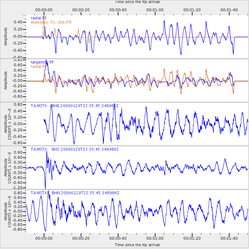
MSTX Muleshoe, TX, USA - Earthquake Result Viewer
*The percent match for this event was below the threshold and hence no stack was calculated.
| Earthquake location: |
Western Brazil |
| Earthquake latitude/longitude: |
-8.1/-71.4 |
| Earthquake time(UTC): |
2009/01/29 (029) 22:28:05 GMT |
| Earthquake Depth: |
602 km |
| Earthquake Magnitude: |
5.7 MW, 5.3 MB, 5.6 MW |
| Earthquake Catalog/Contributor: |
WHDF/NEIC |
|
| Network: |
TA USArray Transportable Network (new EarthScope stations) |
| Station: |
MSTX Muleshoe, TX, USA |
| Lat/Lon: |
33.97 N/102.77 W |
| Elevation: |
1167 m |
|
| Distance: |
51.3 deg |
| Az: |
326.357 deg |
| Baz: |
138.696 deg |
| Ray Param: |
$rayparam |
*The percent match for this event was below the threshold and hence was not used in the summary stack. |
|
| Radial Match: |
62.4426 % |
| Radial Bump: |
400 |
| Transverse Match: |
59.795284 % |
| Transverse Bump: |
400 |
| SOD ConfigId: |
2658 |
| Insert Time: |
2010-03-06 07:49:33.114 +0000 |
| GWidth: |
2.5 |
| Max Bumps: |
400 |
| Tol: |
0.001 |
|
Signal To Noise
| Channel | StoN | STA | LTA |
| TA:MSTX: :BHZ:20090129T22:35:45.348986Z | 4.6347866 | 4.5429994E-7 | 9.80196E-8 |
| TA:MSTX: :BHN:20090129T22:35:45.348986Z | 2.394733 | 5.5044654E-7 | 2.2985718E-7 |
| TA:MSTX: :BHE:20090129T22:35:45.348986Z | 1.1125388 | 2.823058E-7 | 2.5374916E-7 |
| Arrivals |
| Ps | |
| PpPs | |
| PsPs/PpSs | |


