You are here: Home > Network List > TA - USArray Transportable Network (new EarthScope stations) Stations List
> Station MSTX Muleshoe, TX, USA > Earthquake Result Viewer
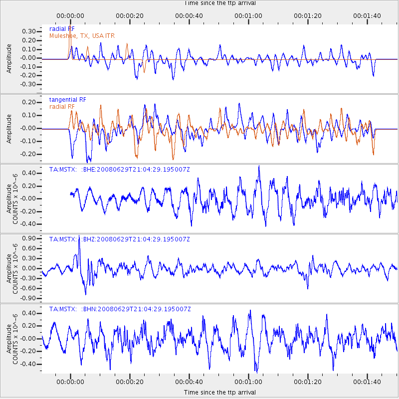
MSTX Muleshoe, TX, USA - Earthquake Result Viewer
*The percent match for this event was below the threshold and hence no stack was calculated.
| Earthquake location: |
Primor'ye, Russia |
| Earthquake latitude/longitude: |
45.2/137.4 |
| Earthquake time(UTC): |
2008/06/29 (181) 20:53:01 GMT |
| Earthquake Depth: |
287 km |
| Earthquake Magnitude: |
5.6 MB, 6.0 MW, 5.9 MW |
| Earthquake Catalog/Contributor: |
WHDF/NEIC |
|
| Network: |
TA USArray Transportable Network (new EarthScope stations) |
| Station: |
MSTX Muleshoe, TX, USA |
| Lat/Lon: |
33.97 N/102.77 W |
| Elevation: |
1167 m |
|
| Distance: |
84.2 deg |
| Az: |
46.454 deg |
| Baz: |
321.899 deg |
| Ray Param: |
$rayparam |
*The percent match for this event was below the threshold and hence was not used in the summary stack. |
|
| Radial Match: |
42.730766 % |
| Radial Bump: |
400 |
| Transverse Match: |
52.200527 % |
| Transverse Bump: |
400 |
| SOD ConfigId: |
2504 |
| Insert Time: |
2010-03-06 07:49:38.353 +0000 |
| GWidth: |
2.5 |
| Max Bumps: |
400 |
| Tol: |
0.001 |
|
Signal To Noise
| Channel | StoN | STA | LTA |
| TA:MSTX: :BHZ:20080629T21:04:29.195007Z | 2.9876485 | 3.551107E-7 | 1.188596E-7 |
| TA:MSTX: :BHN:20080629T21:04:29.195007Z | 1.2309774 | 1.654403E-7 | 1.3439751E-7 |
| TA:MSTX: :BHE:20080629T21:04:29.195007Z | 1.1363946 | 1.08140476E-7 | 9.516102E-8 |
| Arrivals |
| Ps | |
| PpPs | |
| PsPs/PpSs | |


