You are here: Home > Network List > TA - USArray Transportable Network (new EarthScope stations) Stations List
> Station E18K Tukpahlearik Creek, AK, USA > Earthquake Result Viewer
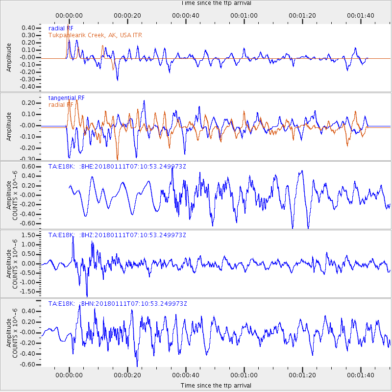
E18K Tukpahlearik Creek, AK, USA - Earthquake Result Viewer
*The percent match for this event was below the threshold and hence no stack was calculated.
| Earthquake location: |
Iran-Iraq Border Region |
| Earthquake latitude/longitude: |
33.8/45.7 |
| Earthquake time(UTC): |
2018/01/11 (011) 06:59:31 GMT |
| Earthquake Depth: |
10 km |
| Earthquake Magnitude: |
5.5 Mww |
| Earthquake Catalog/Contributor: |
NEIC PDE/us |
|
| Network: |
TA USArray Transportable Network (new EarthScope stations) |
| Station: |
E18K Tukpahlearik Creek, AK, USA |
| Lat/Lon: |
67.42 N/160.60 W |
| Elevation: |
297 m |
|
| Distance: |
77.2 deg |
| Az: |
10.125 deg |
| Baz: |
337.713 deg |
| Ray Param: |
$rayparam |
*The percent match for this event was below the threshold and hence was not used in the summary stack. |
|
| Radial Match: |
63.200157 % |
| Radial Bump: |
400 |
| Transverse Match: |
58.304466 % |
| Transverse Bump: |
400 |
| SOD ConfigId: |
13570011 |
| Insert Time: |
2019-04-29 13:09:54.919 +0000 |
| GWidth: |
2.5 |
| Max Bumps: |
400 |
| Tol: |
0.001 |
|
Signal To Noise
| Channel | StoN | STA | LTA |
| TA:E18K: :BHZ:20180111T07:10:53.249973Z | 4.1643224 | 4.8661536E-7 | 1.1685343E-7 |
| TA:E18K: :BHN:20180111T07:10:53.249973Z | 2.293387 | 2.1908541E-7 | 9.5529195E-8 |
| TA:E18K: :BHE:20180111T07:10:53.249973Z | 1.0331064 | 2.001876E-7 | 1.9377248E-7 |
| Arrivals |
| Ps | |
| PpPs | |
| PsPs/PpSs | |


