You are here: Home > Network List > TA - USArray Transportable Network (new EarthScope stations) Stations List
> Station J20K Nowitna River, AK, USA > Earthquake Result Viewer
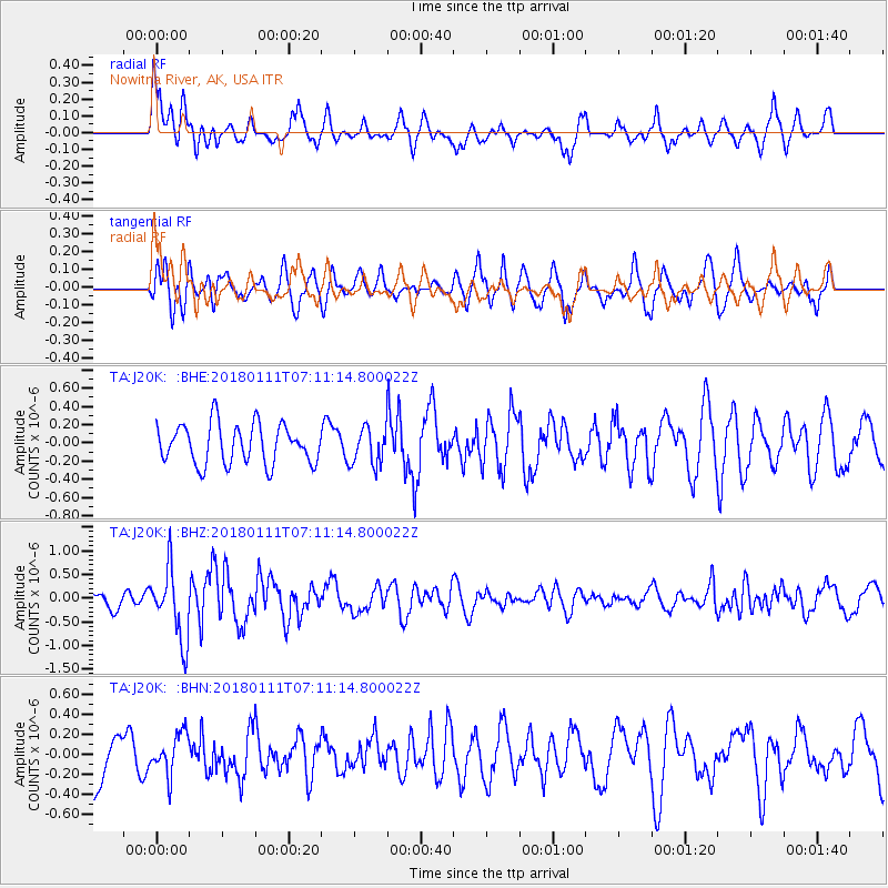
J20K Nowitna River, AK, USA - Earthquake Result Viewer
*The percent match for this event was below the threshold and hence no stack was calculated.
| Earthquake location: |
Iran-Iraq Border Region |
| Earthquake latitude/longitude: |
33.8/45.7 |
| Earthquake time(UTC): |
2018/01/11 (011) 06:59:31 GMT |
| Earthquake Depth: |
10 km |
| Earthquake Magnitude: |
5.5 Mww |
| Earthquake Catalog/Contributor: |
NEIC PDE/us |
|
| Network: |
TA USArray Transportable Network (new EarthScope stations) |
| Station: |
J20K Nowitna River, AK, USA |
| Lat/Lon: |
64.18 N/154.15 W |
| Elevation: |
314 m |
|
| Distance: |
81.1 deg |
| Az: |
8.676 deg |
| Baz: |
343.326 deg |
| Ray Param: |
$rayparam |
*The percent match for this event was below the threshold and hence was not used in the summary stack. |
|
| Radial Match: |
66.47767 % |
| Radial Bump: |
400 |
| Transverse Match: |
55.53594 % |
| Transverse Bump: |
400 |
| SOD ConfigId: |
13570011 |
| Insert Time: |
2019-04-29 13:10:21.673 +0000 |
| GWidth: |
2.5 |
| Max Bumps: |
400 |
| Tol: |
0.001 |
|
Signal To Noise
| Channel | StoN | STA | LTA |
| TA:J20K: :BHZ:20180111T07:11:14.800022Z | 4.3136706 | 7.461937E-7 | 1.7298346E-7 |
| TA:J20K: :BHN:20180111T07:11:14.800022Z | 0.8108339 | 2.060391E-7 | 2.5410768E-7 |
| TA:J20K: :BHE:20180111T07:11:14.800022Z | 1.1328502 | 2.4418495E-7 | 2.155492E-7 |
| Arrivals |
| Ps | |
| PpPs | |
| PsPs/PpSs | |


