You are here: Home > Network List > TA - USArray Transportable Network (new EarthScope stations) Stations List
> Station A21K Barrow, AK, USA > Earthquake Result Viewer
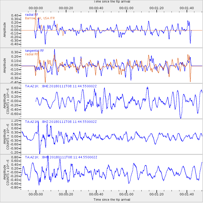
A21K Barrow, AK, USA - Earthquake Result Viewer
*The percent match for this event was below the threshold and hence no stack was calculated.
| Earthquake location: |
Iran-Iraq Border Region |
| Earthquake latitude/longitude: |
33.7/45.7 |
| Earthquake time(UTC): |
2018/01/11 (011) 08:00:39 GMT |
| Earthquake Depth: |
10 km |
| Earthquake Magnitude: |
5.3 Mww |
| Earthquake Catalog/Contributor: |
NEIC PDE/us |
|
| Network: |
TA USArray Transportable Network (new EarthScope stations) |
| Station: |
A21K Barrow, AK, USA |
| Lat/Lon: |
71.32 N/156.62 W |
| Elevation: |
577 m |
|
| Distance: |
74.1 deg |
| Az: |
7.311 deg |
| Baz: |
340.78 deg |
| Ray Param: |
$rayparam |
*The percent match for this event was below the threshold and hence was not used in the summary stack. |
|
| Radial Match: |
64.09542 % |
| Radial Bump: |
400 |
| Transverse Match: |
62.866863 % |
| Transverse Bump: |
395 |
| SOD ConfigId: |
13570011 |
| Insert Time: |
2019-04-29 13:15:04.668 +0000 |
| GWidth: |
2.5 |
| Max Bumps: |
400 |
| Tol: |
0.001 |
|
Signal To Noise
| Channel | StoN | STA | LTA |
| TA:A21K: :BHZ:20180111T08:11:44.550002Z | 2.9271815 | 5.6159377E-7 | 1.9185478E-7 |
| TA:A21K: :BHN:20180111T08:11:44.550002Z | 1.0731946 | 2.7930474E-7 | 2.6025543E-7 |
| TA:A21K: :BHE:20180111T08:11:44.550002Z | 1.7178823 | 3.050595E-7 | 1.7757881E-7 |
| Arrivals |
| Ps | |
| PpPs | |
| PsPs/PpSs | |


