You are here: Home > Network List > TA - USArray Transportable Network (new EarthScope stations) Stations List
> Station B18K Kokolik River, AK, USA > Earthquake Result Viewer
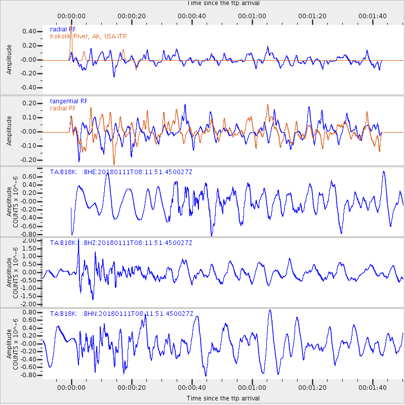
B18K Kokolik River, AK, USA - Earthquake Result Viewer
*The percent match for this event was below the threshold and hence no stack was calculated.
| Earthquake location: |
Iran-Iraq Border Region |
| Earthquake latitude/longitude: |
33.7/45.7 |
| Earthquake time(UTC): |
2018/01/11 (011) 08:00:39 GMT |
| Earthquake Depth: |
10 km |
| Earthquake Magnitude: |
5.3 Mww |
| Earthquake Catalog/Contributor: |
NEIC PDE/us |
|
| Network: |
TA USArray Transportable Network (new EarthScope stations) |
| Station: |
B18K Kokolik River, AK, USA |
| Lat/Lon: |
69.36 N/161.80 W |
| Elevation: |
222 m |
|
| Distance: |
75.3 deg |
| Az: |
9.747 deg |
| Baz: |
336.545 deg |
| Ray Param: |
$rayparam |
*The percent match for this event was below the threshold and hence was not used in the summary stack. |
|
| Radial Match: |
58.408844 % |
| Radial Bump: |
400 |
| Transverse Match: |
38.75582 % |
| Transverse Bump: |
356 |
| SOD ConfigId: |
13570011 |
| Insert Time: |
2019-04-29 13:15:04.762 +0000 |
| GWidth: |
2.5 |
| Max Bumps: |
400 |
| Tol: |
0.001 |
|
Signal To Noise
| Channel | StoN | STA | LTA |
| TA:B18K: :BHZ:20180111T08:11:51.450027Z | 2.4723425 | 6.101561E-7 | 2.467927E-7 |
| TA:B18K: :BHN:20180111T08:11:51.450027Z | 0.8973148 | 2.0250677E-7 | 2.2568085E-7 |
| TA:B18K: :BHE:20180111T08:11:51.450027Z | 1.0090846 | 3.2129742E-7 | 3.1840486E-7 |
| Arrivals |
| Ps | |
| PpPs | |
| PsPs/PpSs | |


