You are here: Home > Network List > US - United States National Seismic Network Stations List
> Station DGMT Dagmar, Montana, USA > Earthquake Result Viewer
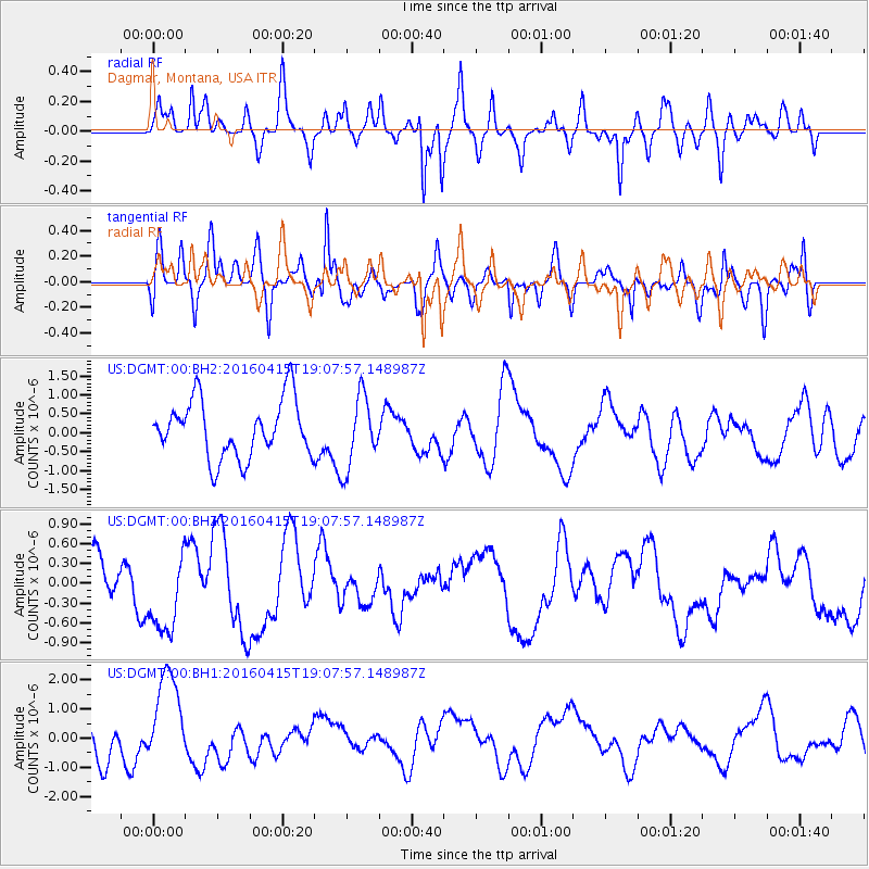
DGMT Dagmar, Montana, USA - Earthquake Result Viewer
*The percent match for this event was below the threshold and hence no stack was calculated.
| Earthquake location: |
Kyushu, Japan |
| Earthquake latitude/longitude: |
33.0/131.2 |
| Earthquake time(UTC): |
2016/04/15 (106) 18:55:53 GMT |
| Earthquake Depth: |
11 km |
| Earthquake Magnitude: |
5.5 MO |
| Earthquake Catalog/Contributor: |
NEIC PDE/NEIC ALERT |
|
| Network: |
US United States National Seismic Network |
| Station: |
DGMT Dagmar, Montana, USA |
| Lat/Lon: |
48.47 N/104.20 W |
| Elevation: |
0.0 m |
|
| Distance: |
85.1 deg |
| Az: |
33.334 deg |
| Baz: |
316.038 deg |
| Ray Param: |
$rayparam |
*The percent match for this event was below the threshold and hence was not used in the summary stack. |
|
| Radial Match: |
56.21049 % |
| Radial Bump: |
351 |
| Transverse Match: |
55.735126 % |
| Transverse Bump: |
400 |
| SOD ConfigId: |
1475611 |
| Insert Time: |
2016-04-29 19:34:20.422 +0000 |
| GWidth: |
2.5 |
| Max Bumps: |
400 |
| Tol: |
0.001 |
|
Signal To Noise
| Channel | StoN | STA | LTA |
| US:DGMT:00:BHZ:20160415T19:07:57.148987Z | 1.493722 | 6.064113E-7 | 4.059733E-7 |
| US:DGMT:00:BH1:20160415T19:07:57.148987Z | 3.4944422 | 1.627002E-6 | 4.6559705E-7 |
| US:DGMT:00:BH2:20160415T19:07:57.148987Z | 1.2519414 | 9.4697964E-7 | 7.5640884E-7 |
| Arrivals |
| Ps | |
| PpPs | |
| PsPs/PpSs | |


