You are here: Home > Network List > CI - Caltech Regional Seismic Network Stations List
> Station DAN Danby, California, USA > Earthquake Result Viewer
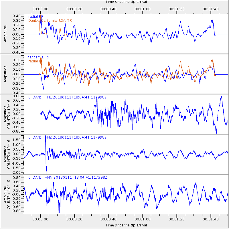
DAN Danby, California, USA - Earthquake Result Viewer
*The percent match for this event was below the threshold and hence no stack was calculated.
| Earthquake location: |
South Of Fiji Islands |
| Earthquake latitude/longitude: |
-23.9/180.0 |
| Earthquake time(UTC): |
2018/01/11 (011) 17:53:33 GMT |
| Earthquake Depth: |
508 km |
| Earthquake Magnitude: |
5.5 Mww |
| Earthquake Catalog/Contributor: |
NEIC PDE/us |
|
| Network: |
CI Caltech Regional Seismic Network |
| Station: |
DAN Danby, California, USA |
| Lat/Lon: |
34.64 N/115.38 W |
| Elevation: |
398 m |
|
| Distance: |
84.6 deg |
| Az: |
48.472 deg |
| Baz: |
236.191 deg |
| Ray Param: |
$rayparam |
*The percent match for this event was below the threshold and hence was not used in the summary stack. |
|
| Radial Match: |
51.325836 % |
| Radial Bump: |
400 |
| Transverse Match: |
61.752777 % |
| Transverse Bump: |
400 |
| SOD ConfigId: |
13570011 |
| Insert Time: |
2019-04-29 13:18:11.534 +0000 |
| GWidth: |
2.5 |
| Max Bumps: |
400 |
| Tol: |
0.001 |
|
Signal To Noise
| Channel | StoN | STA | LTA |
| CI:DAN: :HHZ:20180111T18:04:41.117998Z | 3.22205 | 6.609017E-7 | 2.051184E-7 |
| CI:DAN: :HHN:20180111T18:04:41.117998Z | 0.75221306 | 2.1427043E-7 | 2.8485337E-7 |
| CI:DAN: :HHE:20180111T18:04:41.117998Z | 2.625881 | 3.3652145E-7 | 1.2815563E-7 |
| Arrivals |
| Ps | |
| PpPs | |
| PsPs/PpSs | |


