You are here: Home > Network List > TA - USArray Transportable Network (new EarthScope stations) Stations List
> Station X26A CR and CF Franklin Farms, Melrose, NM, USA > Earthquake Result Viewer
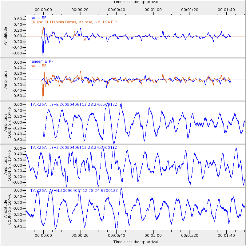
X26A CR and CF Franklin Farms, Melrose, NM, USA - Earthquake Result Viewer
*The percent match for this event was below the threshold and hence no stack was calculated.
| Earthquake location: |
Tonga Islands Region |
| Earthquake latitude/longitude: |
-22.4/-174.9 |
| Earthquake time(UTC): |
2009/04/06 (096) 12:16:08 GMT |
| Earthquake Depth: |
35 km |
| Earthquake Magnitude: |
5.5 MS, 5.4 MB |
| Earthquake Catalog/Contributor: |
WHDF/NEIC |
|
| Network: |
TA USArray Transportable Network (new EarthScope stations) |
| Station: |
X26A CR and CF Franklin Farms, Melrose, NM, USA |
| Lat/Lon: |
34.55 N/103.81 W |
| Elevation: |
1393 m |
|
| Distance: |
88.1 deg |
| Az: |
51.394 deg |
| Baz: |
241.197 deg |
| Ray Param: |
$rayparam |
*The percent match for this event was below the threshold and hence was not used in the summary stack. |
|
| Radial Match: |
63.938217 % |
| Radial Bump: |
400 |
| Transverse Match: |
65.708336 % |
| Transverse Bump: |
315 |
| SOD ConfigId: |
2658 |
| Insert Time: |
2010-03-06 07:51:16.902 +0000 |
| GWidth: |
2.5 |
| Max Bumps: |
400 |
| Tol: |
0.001 |
|
Signal To Noise
| Channel | StoN | STA | LTA |
| TA:X26A: :BHZ:20090406T12:28:24.650012Z | 1.1827029 | 2.7347346E-7 | 2.3122753E-7 |
| TA:X26A: :BHN:20090406T12:28:24.650012Z | 2.9529977 | 4.4882674E-7 | 1.519902E-7 |
| TA:X26A: :BHE:20090406T12:28:24.650012Z | 1.3391995 | 3.9744512E-7 | 2.9677813E-7 |
| Arrivals |
| Ps | |
| PpPs | |
| PsPs/PpSs | |


