You are here: Home > Network List > AG - Arkansas Seismic Network Stations List
> Station LCAR Lake Charles,AR > Earthquake Result Viewer
LCAR Lake Charles,AR - Earthquake Result Viewer

| Earthquake location: |
Near Coast Of Ecuador |
| Earthquake latitude/longitude: |
0.4/-79.9 |
| Earthquake time(UTC): |
2016/04/16 (107) 23:58:37 GMT |
| Earthquake Depth: |
19 km |
| Earthquake Magnitude: |
7.8 MWW, 7.4 MI |
| Earthquake Catalog/Contributor: |
NEIC PDE/NEIC COMCAT |
|
| Network: |
AG Arkansas Seismic Network |
| Station: |
LCAR Lake Charles,AR |
| Lat/Lon: |
36.07 N/91.15 W |
| Elevation: |
103 m |
|
| Distance: |
37.0 deg |
| Az: |
344.828 deg |
| Baz: |
161.154 deg |
| Ray Param: |
0.07634324 |
| Estimated Moho Depth: |
30.25 km |
| Estimated Crust Vp/Vs: |
2.10 |
| Assumed Crust Vp: |
6.53 km/s |
| Estimated Crust Vs: |
3.117 km/s |
| Estimated Crust Poisson's Ratio: |
0.35 |
|
| Radial Match: |
97.426735 % |
| Radial Bump: |
193 |
| Transverse Match: |
92.415115 % |
| Transverse Bump: |
382 |
| SOD ConfigId: |
1475611 |
| Insert Time: |
2016-04-30 23:59:14.308 +0000 |
| GWidth: |
2.5 |
| Max Bumps: |
400 |
| Tol: |
0.001 |
|
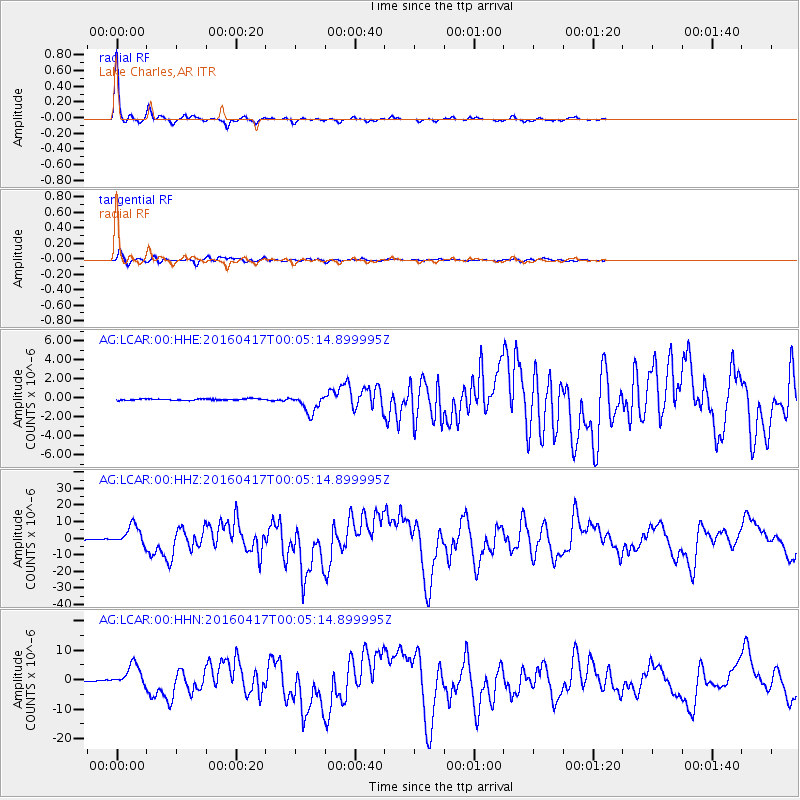
Signal To Noise
| Channel | StoN | STA | LTA |
| AG:LCAR:00:HHZ:20160417T00:05:14.899995Z | 48.405167 | 5.8941473E-6 | 1.217669E-7 |
| AG:LCAR:00:HHN:20160417T00:05:14.899995Z | 35.34657 | 3.6632396E-6 | 1.0363777E-7 |
| AG:LCAR:00:HHE:20160417T00:05:14.899995Z | 12.332549 | 9.4916237E-7 | 7.696401E-8 |
| Arrivals |
| Ps | 5.4 SECOND |
| PpPs | 13 SECOND |
| PsPs/PpSs | 19 SECOND |


