You are here: Home > Network List > CN - Canadian National Seismograph Network Stations List
> Station INK INUVIK, NT > Earthquake Result Viewer
INK INUVIK, NT - Earthquake Result Viewer
*The percent match for this event was below the threshold and hence no stack was calculated.
| Earthquake location: |
Myanmar |
| Earthquake latitude/longitude: |
18.4/96.1 |
| Earthquake time(UTC): |
2018/01/11 (011) 18:26:24 GMT |
| Earthquake Depth: |
10 km |
| Earthquake Magnitude: |
6.0 Mww |
| Earthquake Catalog/Contributor: |
NEIC PDE/us |
|
| Network: |
CN Canadian National Seismograph Network |
| Station: |
INK INUVIK, NT |
| Lat/Lon: |
68.31 N/133.53 W |
| Elevation: |
44 m |
|
| Distance: |
86.5 deg |
| Az: |
16.481 deg |
| Baz: |
313.558 deg |
| Ray Param: |
$rayparam |
*The percent match for this event was below the threshold and hence was not used in the summary stack. |
|
| Radial Match: |
36.79535 % |
| Radial Bump: |
400 |
| Transverse Match: |
33.285934 % |
| Transverse Bump: |
400 |
| SOD ConfigId: |
13570011 |
| Insert Time: |
2019-04-29 13:23:38.499 +0000 |
| GWidth: |
2.5 |
| Max Bumps: |
400 |
| Tol: |
0.001 |
|
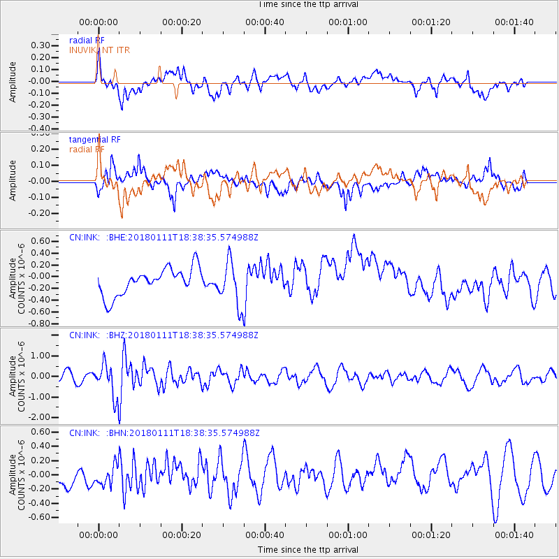
Signal To Noise
| Channel | StoN | STA | LTA |
| CN:INK: :BHZ:20180111T18:38:35.574988Z | 2.9877987 | 8.378169E-7 | 2.8041276E-7 |
| CN:INK: :BHN:20180111T18:38:35.574988Z | 0.6927308 | 1.5234684E-7 | 2.1992216E-7 |
| CN:INK: :BHE:20180111T18:38:35.574988Z | 1.7188244 | 3.9168287E-7 | 2.2787835E-7 |
| Arrivals |
| Ps | |
| PpPs | |
| PsPs/PpSs | |


