You are here: Home > Network List > TA - USArray Transportable Network (new EarthScope stations) Stations List
> Station X26A CR and CF Franklin Farms, Melrose, NM, USA > Earthquake Result Viewer
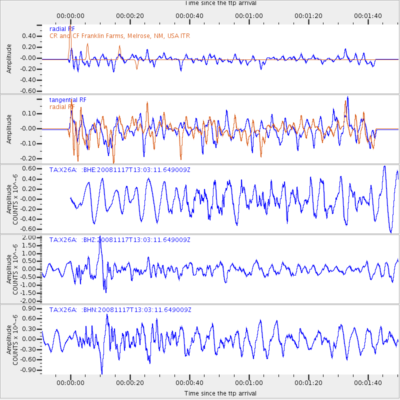
X26A CR and CF Franklin Farms, Melrose, NM, USA - Earthquake Result Viewer
*The percent match for this event was below the threshold and hence no stack was calculated.
| Earthquake location: |
Arctic Ocean |
| Earthquake latitude/longitude: |
79.6/-116.1 |
| Earthquake time(UTC): |
2008/11/17 (322) 12:55:22 GMT |
| Earthquake Depth: |
7.0 km |
| Earthquake Magnitude: |
5.7 MW, 5.2 MS, 5.4 MB, 5.7 MW |
| Earthquake Catalog/Contributor: |
WHDF/NEIC |
|
| Network: |
TA USArray Transportable Network (new EarthScope stations) |
| Station: |
X26A CR and CF Franklin Farms, Melrose, NM, USA |
| Lat/Lon: |
34.55 N/103.81 W |
| Elevation: |
1393 m |
|
| Distance: |
45.5 deg |
| Az: |
165.787 deg |
| Baz: |
356.916 deg |
| Ray Param: |
$rayparam |
*The percent match for this event was below the threshold and hence was not used in the summary stack. |
|
| Radial Match: |
61.943058 % |
| Radial Bump: |
400 |
| Transverse Match: |
61.03491 % |
| Transverse Bump: |
358 |
| SOD ConfigId: |
2658 |
| Insert Time: |
2010-03-06 07:52:23.571 +0000 |
| GWidth: |
2.5 |
| Max Bumps: |
400 |
| Tol: |
0.001 |
|
Signal To Noise
| Channel | StoN | STA | LTA |
| TA:X26A: :BHZ:20081117T13:03:11.649009Z | 1.9882709 | 4.210834E-7 | 2.1178371E-7 |
| TA:X26A: :BHN:20081117T13:03:11.649009Z | 0.62191224 | 1.243801E-7 | 1.9999622E-7 |
| TA:X26A: :BHE:20081117T13:03:11.649009Z | 1.1473353 | 2.4189455E-7 | 2.1083163E-7 |
| Arrivals |
| Ps | |
| PpPs | |
| PsPs/PpSs | |


