You are here: Home > Network List > TA - USArray Transportable Network (new EarthScope stations) Stations List
> Station A21K Barrow, AK, USA > Earthquake Result Viewer
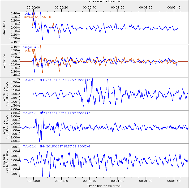
A21K Barrow, AK, USA - Earthquake Result Viewer
*The percent match for this event was below the threshold and hence no stack was calculated.
| Earthquake location: |
Myanmar |
| Earthquake latitude/longitude: |
18.4/96.1 |
| Earthquake time(UTC): |
2018/01/11 (011) 18:26:24 GMT |
| Earthquake Depth: |
10 km |
| Earthquake Magnitude: |
6.0 Mww |
| Earthquake Catalog/Contributor: |
NEIC PDE/us |
|
| Network: |
TA USArray Transportable Network (new EarthScope stations) |
| Station: |
A21K Barrow, AK, USA |
| Lat/Lon: |
71.32 N/156.62 W |
| Elevation: |
577 m |
|
| Distance: |
78.1 deg |
| Az: |
18.319 deg |
| Baz: |
292.106 deg |
| Ray Param: |
$rayparam |
*The percent match for this event was below the threshold and hence was not used in the summary stack. |
|
| Radial Match: |
80.316765 % |
| Radial Bump: |
358 |
| Transverse Match: |
79.15428 % |
| Transverse Bump: |
400 |
| SOD ConfigId: |
13570011 |
| Insert Time: |
2019-04-29 13:25:33.491 +0000 |
| GWidth: |
2.5 |
| Max Bumps: |
400 |
| Tol: |
0.001 |
|
Signal To Noise
| Channel | StoN | STA | LTA |
| TA:A21K: :BHZ:20180111T18:37:52.300024Z | 13.041856 | 1.5936722E-6 | 1.2219672E-7 |
| TA:A21K: :BHN:20180111T18:37:52.300024Z | 3.0987422 | 4.3126886E-7 | 1.3917546E-7 |
| TA:A21K: :BHE:20180111T18:37:52.300024Z | 1.4546297 | 3.503426E-7 | 2.408466E-7 |
| Arrivals |
| Ps | |
| PpPs | |
| PsPs/PpSs | |


