You are here: Home > Network List > TA - USArray Transportable Network (new EarthScope stations) Stations List
> Station B22K Teshekpuk Lake, AK, USA > Earthquake Result Viewer
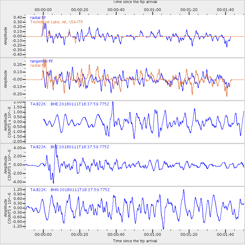
B22K Teshekpuk Lake, AK, USA - Earthquake Result Viewer
*The percent match for this event was below the threshold and hence no stack was calculated.
| Earthquake location: |
Myanmar |
| Earthquake latitude/longitude: |
18.4/96.1 |
| Earthquake time(UTC): |
2018/01/11 (011) 18:26:24 GMT |
| Earthquake Depth: |
10 km |
| Earthquake Magnitude: |
6.0 Mww |
| Earthquake Catalog/Contributor: |
NEIC PDE/us |
|
| Network: |
TA USArray Transportable Network (new EarthScope stations) |
| Station: |
B22K Teshekpuk Lake, AK, USA |
| Lat/Lon: |
70.34 N/153.42 W |
| Elevation: |
50 m |
|
| Distance: |
79.5 deg |
| Az: |
18.808 deg |
| Baz: |
295.219 deg |
| Ray Param: |
$rayparam |
*The percent match for this event was below the threshold and hence was not used in the summary stack. |
|
| Radial Match: |
75.29188 % |
| Radial Bump: |
400 |
| Transverse Match: |
68.99903 % |
| Transverse Bump: |
400 |
| SOD ConfigId: |
13570011 |
| Insert Time: |
2019-04-29 13:25:38.102 +0000 |
| GWidth: |
2.5 |
| Max Bumps: |
400 |
| Tol: |
0.001 |
|
Signal To Noise
| Channel | StoN | STA | LTA |
| TA:B22K: :BHZ:20180111T18:37:59.775Z | 6.262472 | 1.4730917E-6 | 2.3522529E-7 |
| TA:B22K: :BHN:20180111T18:37:59.775Z | 1.4455771 | 5.4474566E-7 | 3.7683608E-7 |
| TA:B22K: :BHE:20180111T18:37:59.775Z | 1.5619602 | 6.218689E-7 | 3.981336E-7 |
| Arrivals |
| Ps | |
| PpPs | |
| PsPs/PpSs | |


