You are here: Home > Network List > TA - USArray Transportable Network (new EarthScope stations) Stations List
> Station C16K Lisburne Hills, AK, USA > Earthquake Result Viewer
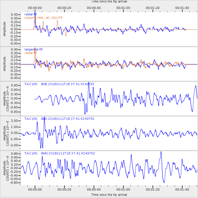
C16K Lisburne Hills, AK, USA - Earthquake Result Viewer
*The percent match for this event was below the threshold and hence no stack was calculated.
| Earthquake location: |
Myanmar |
| Earthquake latitude/longitude: |
18.4/96.1 |
| Earthquake time(UTC): |
2018/01/11 (011) 18:26:24 GMT |
| Earthquake Depth: |
10 km |
| Earthquake Magnitude: |
6.0 Mww |
| Earthquake Catalog/Contributor: |
NEIC PDE/us |
|
| Network: |
TA USArray Transportable Network (new EarthScope stations) |
| Station: |
C16K Lisburne Hills, AK, USA |
| Lat/Lon: |
68.27 N/165.34 W |
| Elevation: |
102 m |
|
| Distance: |
76.2 deg |
| Az: |
22.273 deg |
| Baz: |
284.795 deg |
| Ray Param: |
$rayparam |
*The percent match for this event was below the threshold and hence was not used in the summary stack. |
|
| Radial Match: |
76.82721 % |
| Radial Bump: |
400 |
| Transverse Match: |
66.825554 % |
| Transverse Bump: |
400 |
| SOD ConfigId: |
13570011 |
| Insert Time: |
2019-04-29 13:25:38.314 +0000 |
| GWidth: |
2.5 |
| Max Bumps: |
400 |
| Tol: |
0.001 |
|
Signal To Noise
| Channel | StoN | STA | LTA |
| TA:C16K: :BHZ:20180111T18:37:41.624976Z | 6.471313 | 1.0418614E-6 | 1.6099692E-7 |
| TA:C16K: :BHN:20180111T18:37:41.624976Z | 2.9464269 | 3.1761238E-7 | 1.0779578E-7 |
| TA:C16K: :BHE:20180111T18:37:41.624976Z | 2.299746 | 3.786711E-7 | 1.6465779E-7 |
| Arrivals |
| Ps | |
| PpPs | |
| PsPs/PpSs | |


