You are here: Home > Network List > TA - USArray Transportable Network (new EarthScope stations) Stations List
> Station G16K Koyuk River, AK, USA > Earthquake Result Viewer
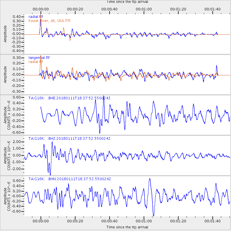
G16K Koyuk River, AK, USA - Earthquake Result Viewer
*The percent match for this event was below the threshold and hence no stack was calculated.
| Earthquake location: |
Myanmar |
| Earthquake latitude/longitude: |
18.4/96.1 |
| Earthquake time(UTC): |
2018/01/11 (011) 18:26:24 GMT |
| Earthquake Depth: |
10 km |
| Earthquake Magnitude: |
6.0 Mww |
| Earthquake Catalog/Contributor: |
NEIC PDE/us |
|
| Network: |
TA USArray Transportable Network (new EarthScope stations) |
| Station: |
G16K Koyuk River, AK, USA |
| Lat/Lon: |
65.39 N/162.35 W |
| Elevation: |
169 m |
|
| Distance: |
78.2 deg |
| Az: |
24.776 deg |
| Baz: |
288.095 deg |
| Ray Param: |
$rayparam |
*The percent match for this event was below the threshold and hence was not used in the summary stack. |
|
| Radial Match: |
72.99262 % |
| Radial Bump: |
394 |
| Transverse Match: |
58.00659 % |
| Transverse Bump: |
400 |
| SOD ConfigId: |
13570011 |
| Insert Time: |
2019-04-29 13:26:08.515 +0000 |
| GWidth: |
2.5 |
| Max Bumps: |
400 |
| Tol: |
0.001 |
|
Signal To Noise
| Channel | StoN | STA | LTA |
| TA:G16K: :BHZ:20180111T18:37:52.550024Z | 4.231682 | 9.0782726E-7 | 2.1453108E-7 |
| TA:G16K: :BHN:20180111T18:37:52.550024Z | 0.97248524 | 1.753555E-7 | 1.8031687E-7 |
| TA:G16K: :BHE:20180111T18:37:52.550024Z | 1.8581784 | 2.7733546E-7 | 1.4925126E-7 |
| Arrivals |
| Ps | |
| PpPs | |
| PsPs/PpSs | |


