You are here: Home > Network List > TA - USArray Transportable Network (new EarthScope stations) Stations List
> Station X26A CR and CF Franklin Farms, Melrose, NM, USA > Earthquake Result Viewer
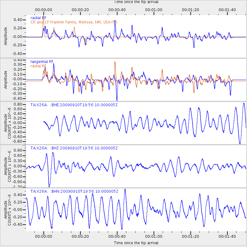
X26A CR and CF Franklin Farms, Melrose, NM, USA - Earthquake Result Viewer
*The percent match for this event was below the threshold and hence no stack was calculated.
| Earthquake location: |
Easter Island Region |
| Earthquake latitude/longitude: |
-29.9/-111.8 |
| Earthquake time(UTC): |
2009/09/10 (253) 19:46:03 GMT |
| Earthquake Depth: |
10 km |
| Earthquake Magnitude: |
5.5 MW, 5.4 MB |
| Earthquake Catalog/Contributor: |
WHDF/NEIC |
|
| Network: |
TA USArray Transportable Network (new EarthScope stations) |
| Station: |
X26A CR and CF Franklin Farms, Melrose, NM, USA |
| Lat/Lon: |
34.55 N/103.81 W |
| Elevation: |
1393 m |
|
| Distance: |
64.6 deg |
| Az: |
7.32 deg |
| Baz: |
187.701 deg |
| Ray Param: |
$rayparam |
*The percent match for this event was below the threshold and hence was not used in the summary stack. |
|
| Radial Match: |
56.544693 % |
| Radial Bump: |
400 |
| Transverse Match: |
47.569775 % |
| Transverse Bump: |
325 |
| SOD ConfigId: |
2622 |
| Insert Time: |
2010-03-06 07:52:36.866 +0000 |
| GWidth: |
2.5 |
| Max Bumps: |
400 |
| Tol: |
0.001 |
|
Signal To Noise
| Channel | StoN | STA | LTA |
| TA:X26A: :BHZ:20090910T19:56:10.000005Z | 3.8789856 | 5.6586356E-7 | 1.4587927E-7 |
| TA:X26A: :BHN:20090910T19:56:10.000005Z | 1.3721199 | 2.543501E-7 | 1.8537018E-7 |
| TA:X26A: :BHE:20090910T19:56:10.000005Z | 0.611796 | 1.2484396E-7 | 2.0406142E-7 |
| Arrivals |
| Ps | |
| PpPs | |
| PsPs/PpSs | |


