You are here: Home > Network List > TA - USArray Transportable Network (new EarthScope stations) Stations List
> Station K13K Kusilvak Mountain, AK, USA > Earthquake Result Viewer
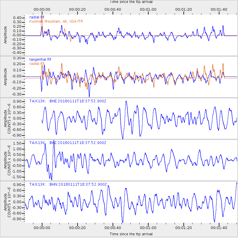
K13K Kusilvak Mountain, AK, USA - Earthquake Result Viewer
*The percent match for this event was below the threshold and hence no stack was calculated.
| Earthquake location: |
Myanmar |
| Earthquake latitude/longitude: |
18.4/96.1 |
| Earthquake time(UTC): |
2018/01/11 (011) 18:26:24 GMT |
| Earthquake Depth: |
10 km |
| Earthquake Magnitude: |
6.0 Mww |
| Earthquake Catalog/Contributor: |
NEIC PDE/us |
|
| Network: |
TA USArray Transportable Network (new EarthScope stations) |
| Station: |
K13K Kusilvak Mountain, AK, USA |
| Lat/Lon: |
61.93 N/164.66 W |
| Elevation: |
204 m |
|
| Distance: |
78.3 deg |
| Az: |
28.475 deg |
| Baz: |
286.79 deg |
| Ray Param: |
$rayparam |
*The percent match for this event was below the threshold and hence was not used in the summary stack. |
|
| Radial Match: |
52.716843 % |
| Radial Bump: |
347 |
| Transverse Match: |
63.885277 % |
| Transverse Bump: |
400 |
| SOD ConfigId: |
13570011 |
| Insert Time: |
2019-04-29 13:26:45.905 +0000 |
| GWidth: |
2.5 |
| Max Bumps: |
400 |
| Tol: |
0.001 |
|
Signal To Noise
| Channel | StoN | STA | LTA |
| TA:K13K: :BHZ:20180111T18:37:52.900Z | 2.9475014 | 8.6231665E-7 | 2.9255852E-7 |
| TA:K13K: :BHN:20180111T18:37:52.900Z | 0.6803323 | 1.9470417E-7 | 2.8618982E-7 |
| TA:K13K: :BHE:20180111T18:37:52.900Z | 1.2959126 | 4.0051034E-7 | 3.090566E-7 |
| Arrivals |
| Ps | |
| PpPs | |
| PsPs/PpSs | |


