You are here: Home > Network List > TA - USArray Transportable Network (new EarthScope stations) Stations List
> Station J26L Joseph Creek, AK, USA > Earthquake Result Viewer
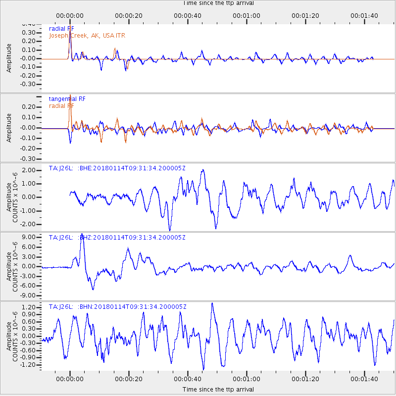
J26L Joseph Creek, AK, USA - Earthquake Result Viewer
*The percent match for this event was below the threshold and hence no stack was calculated.
| Earthquake location: |
Near Coast Of Peru |
| Earthquake latitude/longitude: |
-15.8/-74.7 |
| Earthquake time(UTC): |
2018/01/14 (014) 09:18:45 GMT |
| Earthquake Depth: |
36 km |
| Earthquake Magnitude: |
7.1 mww |
| Earthquake Catalog/Contributor: |
NEIC PDE/us |
|
| Network: |
TA USArray Transportable Network (new EarthScope stations) |
| Station: |
J26L Joseph Creek, AK, USA |
| Lat/Lon: |
64.50 N/143.56 W |
| Elevation: |
1144 m |
|
| Distance: |
95.3 deg |
| Az: |
336.086 deg |
| Baz: |
115.621 deg |
| Ray Param: |
$rayparam |
*The percent match for this event was below the threshold and hence was not used in the summary stack. |
|
| Radial Match: |
79.347275 % |
| Radial Bump: |
370 |
| Transverse Match: |
66.761566 % |
| Transverse Bump: |
400 |
| SOD ConfigId: |
13570011 |
| Insert Time: |
2019-04-29 13:43:55.547 +0000 |
| GWidth: |
2.5 |
| Max Bumps: |
400 |
| Tol: |
0.001 |
|
Signal To Noise
| Channel | StoN | STA | LTA |
| TA:J26L: :BHZ:20180114T09:31:34.200005Z | 7.6910243 | 4.608798E-6 | 5.992437E-7 |
| TA:J26L: :BHN:20180114T09:31:34.200005Z | 1.1457981 | 5.3065463E-7 | 4.6313102E-7 |
| TA:J26L: :BHE:20180114T09:31:34.200005Z | 4.4025397 | 1.2471058E-6 | 2.8326966E-7 |
| Arrivals |
| Ps | |
| PpPs | |
| PsPs/PpSs | |


