You are here: Home > Network List > TA - USArray Transportable Network (new EarthScope stations) Stations List
> Station Z23A Rita Site, White Sands Missle Range, NM, USA > Earthquake Result Viewer
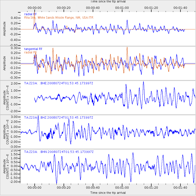
Z23A Rita Site, White Sands Missle Range, NM, USA - Earthquake Result Viewer
*The percent match for this event was below the threshold and hence no stack was calculated.
| Earthquake location: |
Kuril Islands |
| Earthquake latitude/longitude: |
51.0/157.6 |
| Earthquake time(UTC): |
2008/07/24 (206) 01:43:16 GMT |
| Earthquake Depth: |
27 km |
| Earthquake Magnitude: |
6.0 MB, 6.0 MS, 6.2 MW, 6.2 MW |
| Earthquake Catalog/Contributor: |
WHDF/NEIC |
|
| Network: |
TA USArray Transportable Network (new EarthScope stations) |
| Station: |
Z23A Rita Site, White Sands Missle Range, NM, USA |
| Lat/Lon: |
33.26 N/106.23 W |
| Elevation: |
1278 m |
|
| Distance: |
68.5 deg |
| Az: |
63.511 deg |
| Baz: |
317.51 deg |
| Ray Param: |
$rayparam |
*The percent match for this event was below the threshold and hence was not used in the summary stack. |
|
| Radial Match: |
74.81555 % |
| Radial Bump: |
400 |
| Transverse Match: |
70.69352 % |
| Transverse Bump: |
400 |
| SOD ConfigId: |
2504 |
| Insert Time: |
2010-03-06 07:58:04.952 +0000 |
| GWidth: |
2.5 |
| Max Bumps: |
400 |
| Tol: |
0.001 |
|
Signal To Noise
| Channel | StoN | STA | LTA |
| TA:Z23A: :BHZ:20080724T01:53:45.173997Z | 9.510099 | 1.3151592E-6 | 1.382908E-7 |
| TA:Z23A: :BHN:20080724T01:53:45.173997Z | 1.3099126 | 3.8577716E-7 | 2.9450604E-7 |
| TA:Z23A: :BHE:20080724T01:53:45.173997Z | 1.9295259 | 4.1849847E-7 | 2.1689188E-7 |
| Arrivals |
| Ps | |
| PpPs | |
| PsPs/PpSs | |


