You are here: Home > Network List > TA - USArray Transportable Network (new EarthScope stations) Stations List
> Station C16K Lisburne Hills, AK, USA > Earthquake Result Viewer
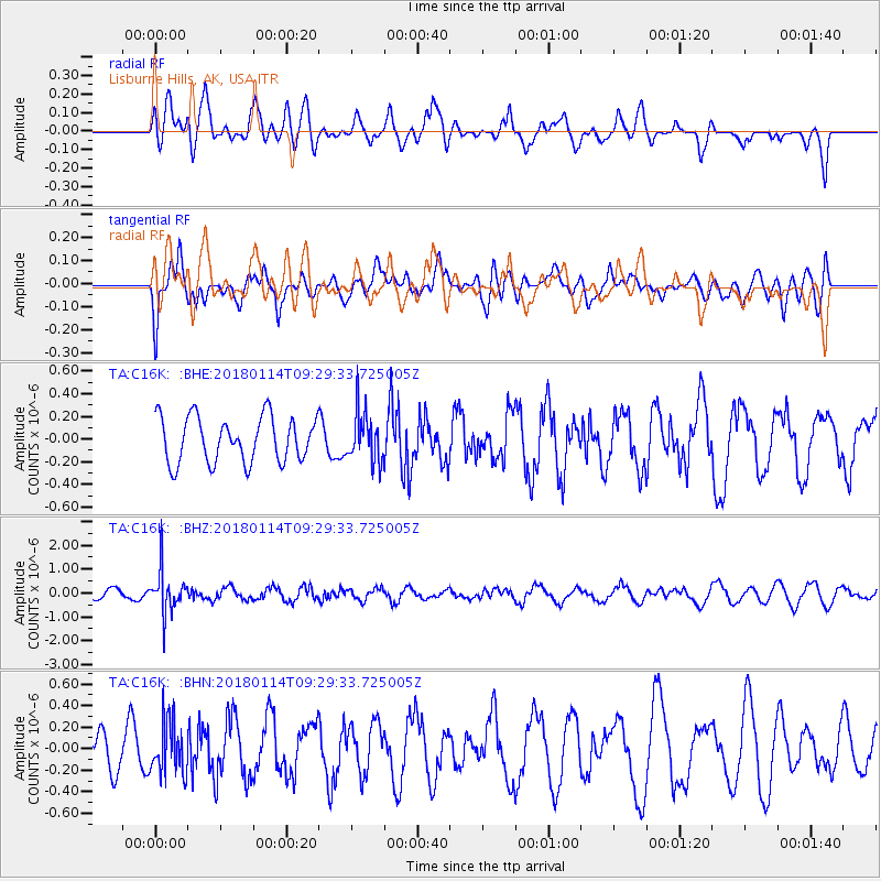
C16K Lisburne Hills, AK, USA - Earthquake Result Viewer
*The percent match for this event was below the threshold and hence no stack was calculated.
| Earthquake location: |
Hindu Kush Region, Afghanistan |
| Earthquake latitude/longitude: |
36.5/70.7 |
| Earthquake time(UTC): |
2018/01/14 (014) 09:19:29 GMT |
| Earthquake Depth: |
200 km |
| Earthquake Magnitude: |
5.3 Mww |
| Earthquake Catalog/Contributor: |
NEIC PDE/us |
|
| Network: |
TA USArray Transportable Network (new EarthScope stations) |
| Station: |
C16K Lisburne Hills, AK, USA |
| Lat/Lon: |
68.27 N/165.34 W |
| Elevation: |
102 m |
|
| Distance: |
67.6 deg |
| Az: |
19.524 deg |
| Baz: |
313.636 deg |
| Ray Param: |
$rayparam |
*The percent match for this event was below the threshold and hence was not used in the summary stack. |
|
| Radial Match: |
68.03231 % |
| Radial Bump: |
400 |
| Transverse Match: |
54.111572 % |
| Transverse Bump: |
400 |
| SOD ConfigId: |
13570011 |
| Insert Time: |
2019-04-29 13:50:51.183 +0000 |
| GWidth: |
2.5 |
| Max Bumps: |
400 |
| Tol: |
0.001 |
|
Signal To Noise
| Channel | StoN | STA | LTA |
| TA:C16K: :BHZ:20180114T09:29:33.725005Z | 4.5059924 | 8.524889E-7 | 1.8919005E-7 |
| TA:C16K: :BHN:20180114T09:29:33.725005Z | 1.2852693 | 2.448807E-7 | 1.9052872E-7 |
| TA:C16K: :BHE:20180114T09:29:33.725005Z | 1.0805 | 2.1533552E-7 | 1.9929247E-7 |
| Arrivals |
| Ps | |
| PpPs | |
| PsPs/PpSs | |


