You are here: Home > Network List > TA - USArray Transportable Network (new EarthScope stations) Stations List
> Station Z23A Rita Site, White Sands Missle Range, NM, USA > Earthquake Result Viewer
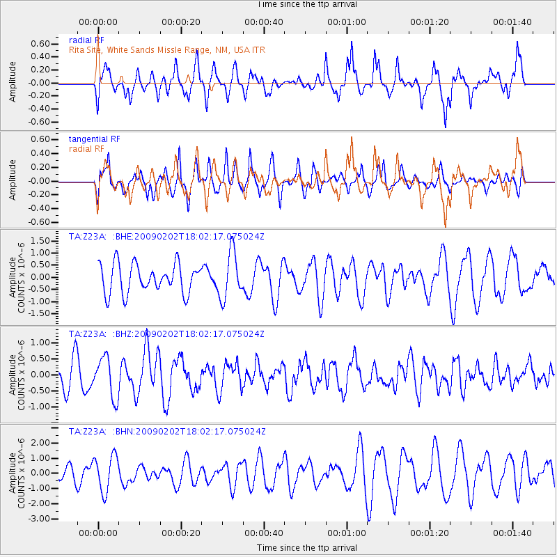
Z23A Rita Site, White Sands Missle Range, NM, USA - Earthquake Result Viewer
*The percent match for this event was below the threshold and hence no stack was calculated.
| Earthquake location: |
Near Coast Of Peru |
| Earthquake latitude/longitude: |
-13.6/-76.6 |
| Earthquake time(UTC): |
2009/02/02 (033) 17:53:21 GMT |
| Earthquake Depth: |
21 km |
| Earthquake Magnitude: |
5.6 MB, 5.6 MS, 6.0 MW, 5.9 MW |
| Earthquake Catalog/Contributor: |
WHDF/NEIC |
|
| Network: |
TA USArray Transportable Network (new EarthScope stations) |
| Station: |
Z23A Rita Site, White Sands Missle Range, NM, USA |
| Lat/Lon: |
33.26 N/106.23 W |
| Elevation: |
1278 m |
|
| Distance: |
54.5 deg |
| Az: |
329.376 deg |
| Baz: |
143.758 deg |
| Ray Param: |
$rayparam |
*The percent match for this event was below the threshold and hence was not used in the summary stack. |
|
| Radial Match: |
63.710377 % |
| Radial Bump: |
378 |
| Transverse Match: |
56.538567 % |
| Transverse Bump: |
393 |
| SOD ConfigId: |
6627 |
| Insert Time: |
2010-03-06 07:58:37.054 +0000 |
| GWidth: |
2.5 |
| Max Bumps: |
400 |
| Tol: |
0.001 |
|
Signal To Noise
| Channel | StoN | STA | LTA |
| TA:Z23A: :BHZ:20090202T18:02:17.075024Z | 2.1020749 | 6.4748133E-7 | 3.0802013E-7 |
| TA:Z23A: :BHN:20090202T18:02:17.075024Z | 2.360209 | 1.2083417E-6 | 5.1196383E-7 |
| TA:Z23A: :BHE:20090202T18:02:17.075024Z | 1.6391536 | 9.84257E-7 | 6.004666E-7 |
| Arrivals |
| Ps | |
| PpPs | |
| PsPs/PpSs | |


