You are here: Home > Network List > TA - USArray Transportable Network (new EarthScope stations) Stations List
> Station F21K Alatna River, AK, USA > Earthquake Result Viewer
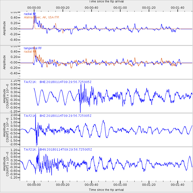
F21K Alatna River, AK, USA - Earthquake Result Viewer
*The percent match for this event was below the threshold and hence no stack was calculated.
| Earthquake location: |
Hindu Kush Region, Afghanistan |
| Earthquake latitude/longitude: |
36.5/70.7 |
| Earthquake time(UTC): |
2018/01/14 (014) 09:19:29 GMT |
| Earthquake Depth: |
200 km |
| Earthquake Magnitude: |
5.3 Mww |
| Earthquake Catalog/Contributor: |
NEIC PDE/us |
|
| Network: |
TA USArray Transportable Network (new EarthScope stations) |
| Station: |
F21K Alatna River, AK, USA |
| Lat/Lon: |
67.22 N/153.48 W |
| Elevation: |
597 m |
|
| Distance: |
71.3 deg |
| Az: |
16.654 deg |
| Baz: |
323.6 deg |
| Ray Param: |
$rayparam |
*The percent match for this event was below the threshold and hence was not used in the summary stack. |
|
| Radial Match: |
74.94448 % |
| Radial Bump: |
400 |
| Transverse Match: |
55.62947 % |
| Transverse Bump: |
400 |
| SOD ConfigId: |
13570011 |
| Insert Time: |
2019-04-29 13:51:09.184 +0000 |
| GWidth: |
2.5 |
| Max Bumps: |
400 |
| Tol: |
0.001 |
|
Signal To Noise
| Channel | StoN | STA | LTA |
| TA:F21K: :BHZ:20180114T09:29:56.725005Z | 3.0441842 | 7.578894E-7 | 2.4896306E-7 |
| TA:F21K: :BHN:20180114T09:29:56.725005Z | 1.4322748 | 4.6276838E-7 | 3.2310027E-7 |
| TA:F21K: :BHE:20180114T09:29:56.725005Z | 1.1010069 | 3.9650394E-7 | 3.601285E-7 |
| Arrivals |
| Ps | |
| PpPs | |
| PsPs/PpSs | |


