You are here: Home > Network List > US - United States National Seismic Network Stations List
> Station BRAL Brewton, Alabama, USA > Earthquake Result Viewer
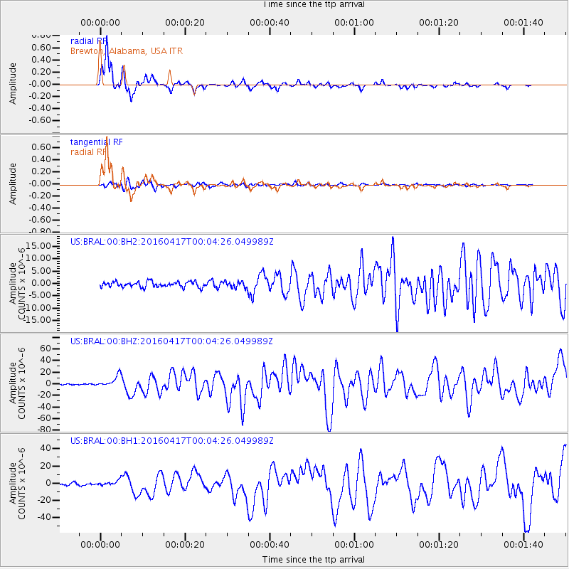
BRAL Brewton, Alabama, USA - Earthquake Result Viewer
*The percent match for this event was below the threshold and hence no stack was calculated.
| Earthquake location: |
Near Coast Of Ecuador |
| Earthquake latitude/longitude: |
0.4/-79.9 |
| Earthquake time(UTC): |
2016/04/16 (107) 23:58:37 GMT |
| Earthquake Depth: |
19 km |
| Earthquake Magnitude: |
7.8 MWW, 7.4 MI |
| Earthquake Catalog/Contributor: |
NEIC PDE/NEIC COMCAT |
|
| Network: |
US United States National Seismic Network |
| Station: |
BRAL Brewton, Alabama, USA |
| Lat/Lon: |
31.17 N/87.05 W |
| Elevation: |
61 m |
|
| Distance: |
31.4 deg |
| Az: |
348.236 deg |
| Baz: |
166.241 deg |
| Ray Param: |
$rayparam |
*The percent match for this event was below the threshold and hence was not used in the summary stack. |
|
| Radial Match: |
95.57355 % |
| Radial Bump: |
262 |
| Transverse Match: |
90.09247 % |
| Transverse Bump: |
400 |
| SOD ConfigId: |
1475611 |
| Insert Time: |
2016-05-01 00:15:21.681 +0000 |
| GWidth: |
2.5 |
| Max Bumps: |
400 |
| Tol: |
0.001 |
|
Signal To Noise
| Channel | StoN | STA | LTA |
| US:BRAL:00:BHZ:20160417T00:04:26.049989Z | 15.197506 | 1.0124991E-5 | 6.6622715E-7 |
| US:BRAL:00:BH1:20160417T00:04:26.049989Z | 2.612418 | 3.1108812E-6 | 1.1908053E-6 |
| US:BRAL:00:BH2:20160417T00:04:26.049989Z | 1.1444021 | 1.2398287E-6 | 1.0833854E-6 |
| Arrivals |
| Ps | |
| PpPs | |
| PsPs/PpSs | |


