You are here: Home > Network List > TA - USArray Transportable Network (new EarthScope stations) Stations List
> Station Z23A Rita Site, White Sands Missle Range, NM, USA > Earthquake Result Viewer
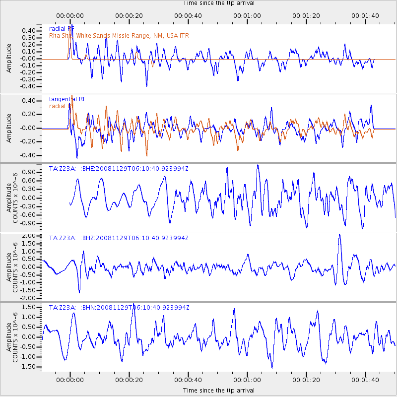
Z23A Rita Site, White Sands Missle Range, NM, USA - Earthquake Result Viewer
*The percent match for this event was below the threshold and hence no stack was calculated.
| Earthquake location: |
Fiji Islands Region |
| Earthquake latitude/longitude: |
-18.7/-177.7 |
| Earthquake time(UTC): |
2008/11/29 (334) 05:59:16 GMT |
| Earthquake Depth: |
386 km |
| Earthquake Magnitude: |
5.7 MB, 6.0 MW, 5.9 MW |
| Earthquake Catalog/Contributor: |
WHDF/NEIC |
|
| Network: |
TA USArray Transportable Network (new EarthScope stations) |
| Station: |
Z23A Rita Site, White Sands Missle Range, NM, USA |
| Lat/Lon: |
33.26 N/106.23 W |
| Elevation: |
1278 m |
|
| Distance: |
85.5 deg |
| Az: |
52.837 deg |
| Baz: |
244.363 deg |
| Ray Param: |
$rayparam |
*The percent match for this event was below the threshold and hence was not used in the summary stack. |
|
| Radial Match: |
49.96334 % |
| Radial Bump: |
400 |
| Transverse Match: |
65.447136 % |
| Transverse Bump: |
400 |
| SOD ConfigId: |
2658 |
| Insert Time: |
2010-03-06 07:59:56.448 +0000 |
| GWidth: |
2.5 |
| Max Bumps: |
400 |
| Tol: |
0.001 |
|
Signal To Noise
| Channel | StoN | STA | LTA |
| TA:Z23A: :BHZ:20081129T06:10:40.923994Z | 2.1122947 | 6.393388E-7 | 3.0267498E-7 |
| TA:Z23A: :BHN:20081129T06:10:40.923994Z | 1.6050705 | 6.627333E-7 | 4.1289985E-7 |
| TA:Z23A: :BHE:20081129T06:10:40.923994Z | 1.5921867 | 5.294892E-7 | 3.3255475E-7 |
| Arrivals |
| Ps | |
| PpPs | |
| PsPs/PpSs | |


