You are here: Home > Network List > CI - Caltech Regional Seismic Network Stations List
> Station BFS Mt Baldy Forest Station > Earthquake Result Viewer
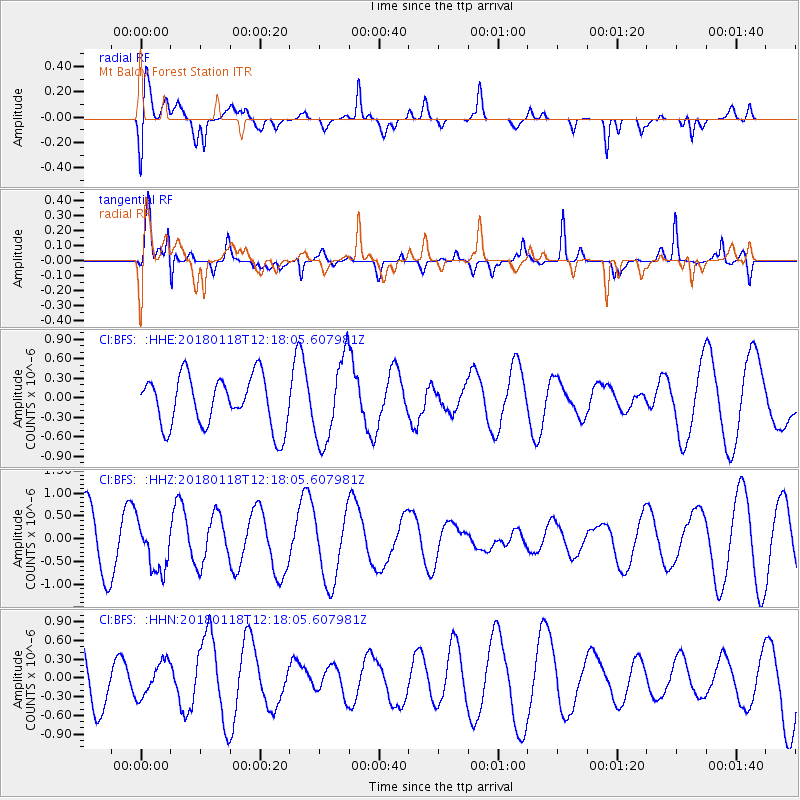
BFS Mt Baldy Forest Station - Earthquake Result Viewer
*The percent match for this event was below the threshold and hence no stack was calculated.
| Earthquake location: |
Northwest Of Kuril Islands |
| Earthquake latitude/longitude: |
52.6/153.0 |
| Earthquake time(UTC): |
2018/01/18 (018) 12:08:52 GMT |
| Earthquake Depth: |
448 km |
| Earthquake Magnitude: |
5.7 Mww |
| Earthquake Catalog/Contributor: |
NEIC PDE/us |
|
| Network: |
CI Caltech Regional Seismic Network |
| Station: |
BFS Mt Baldy Forest Station |
| Lat/Lon: |
34.24 N/117.66 W |
| Elevation: |
1312 m |
|
| Distance: |
63.3 deg |
| Az: |
68.008 deg |
| Baz: |
316.906 deg |
| Ray Param: |
$rayparam |
*The percent match for this event was below the threshold and hence was not used in the summary stack. |
|
| Radial Match: |
57.00098 % |
| Radial Bump: |
400 |
| Transverse Match: |
69.05112 % |
| Transverse Bump: |
400 |
| SOD ConfigId: |
13570011 |
| Insert Time: |
2019-04-29 14:24:05.149 +0000 |
| GWidth: |
2.5 |
| Max Bumps: |
400 |
| Tol: |
0.001 |
|
Signal To Noise
| Channel | StoN | STA | LTA |
| CI:BFS: :HHZ:20180118T12:18:05.607981Z | 1.1022733 | 5.483218E-7 | 4.9744625E-7 |
| CI:BFS: :HHN:20180118T12:18:05.607981Z | 0.42915428 | 2.7608067E-7 | 6.4331334E-7 |
| CI:BFS: :HHE:20180118T12:18:05.607981Z | 1.6495805 | 6.379857E-7 | 3.8675634E-7 |
| Arrivals |
| Ps | |
| PpPs | |
| PsPs/PpSs | |


