You are here: Home > Network List > CI - Caltech Regional Seismic Network Stations List
> Station EDW2 EDW2, Mojave, CA, USA > Earthquake Result Viewer
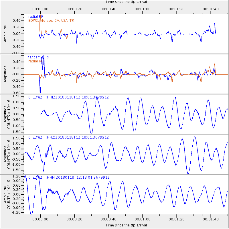
EDW2 EDW2, Mojave, CA, USA - Earthquake Result Viewer
*The percent match for this event was below the threshold and hence no stack was calculated.
| Earthquake location: |
Northwest Of Kuril Islands |
| Earthquake latitude/longitude: |
52.6/153.0 |
| Earthquake time(UTC): |
2018/01/18 (018) 12:08:52 GMT |
| Earthquake Depth: |
448 km |
| Earthquake Magnitude: |
5.7 Mww |
| Earthquake Catalog/Contributor: |
NEIC PDE/us |
|
| Network: |
CI Caltech Regional Seismic Network |
| Station: |
EDW2 EDW2, Mojave, CA, USA |
| Lat/Lon: |
34.88 N/117.99 W |
| Elevation: |
772 m |
|
| Distance: |
62.6 deg |
| Az: |
67.741 deg |
| Baz: |
316.595 deg |
| Ray Param: |
$rayparam |
*The percent match for this event was below the threshold and hence was not used in the summary stack. |
|
| Radial Match: |
40.138126 % |
| Radial Bump: |
361 |
| Transverse Match: |
70.702736 % |
| Transverse Bump: |
400 |
| SOD ConfigId: |
13570011 |
| Insert Time: |
2019-04-29 14:24:10.537 +0000 |
| GWidth: |
2.5 |
| Max Bumps: |
400 |
| Tol: |
0.001 |
|
Signal To Noise
| Channel | StoN | STA | LTA |
| CI:EDW2: :HHZ:20180118T12:18:01.367991Z | 3.0694456 | 6.3878406E-7 | 2.0811055E-7 |
| CI:EDW2: :HHN:20180118T12:18:01.367991Z | 1.3340812 | 7.077094E-7 | 5.304845E-7 |
| CI:EDW2: :HHE:20180118T12:18:01.367991Z | 5.0891438 | 1.158707E-6 | 2.2768211E-7 |
| Arrivals |
| Ps | |
| PpPs | |
| PsPs/PpSs | |


