You are here: Home > Network List > CN - Canadian National Seismograph Network Stations List
> Station INK INUVIK, NT > Earthquake Result Viewer
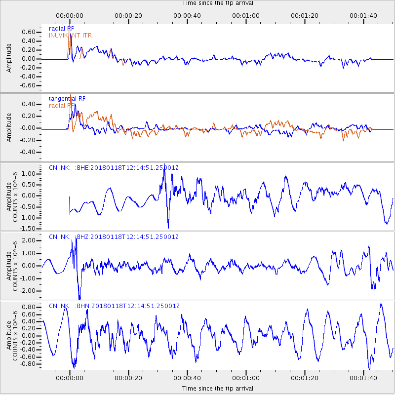
INK INUVIK, NT - Earthquake Result Viewer
*The percent match for this event was below the threshold and hence no stack was calculated.
| Earthquake location: |
Northwest Of Kuril Islands |
| Earthquake latitude/longitude: |
52.6/153.0 |
| Earthquake time(UTC): |
2018/01/18 (018) 12:08:52 GMT |
| Earthquake Depth: |
448 km |
| Earthquake Magnitude: |
5.7 Mww |
| Earthquake Catalog/Contributor: |
NEIC PDE/us |
|
| Network: |
CN Canadian National Seismograph Network |
| Station: |
INK INUVIK, NT |
| Lat/Lon: |
68.31 N/133.53 W |
| Elevation: |
44 m |
|
| Distance: |
36.9 deg |
| Az: |
36.429 deg |
| Baz: |
282.849 deg |
| Ray Param: |
$rayparam |
*The percent match for this event was below the threshold and hence was not used in the summary stack. |
|
| Radial Match: |
43.175613 % |
| Radial Bump: |
400 |
| Transverse Match: |
71.153046 % |
| Transverse Bump: |
400 |
| SOD ConfigId: |
13570011 |
| Insert Time: |
2019-04-29 14:25:00.701 +0000 |
| GWidth: |
2.5 |
| Max Bumps: |
400 |
| Tol: |
0.001 |
|
Signal To Noise
| Channel | StoN | STA | LTA |
| CN:INK: :BHZ:20180118T12:14:51.25001Z | 4.2341423 | 1.3317707E-6 | 3.145314E-7 |
| CN:INK: :BHN:20180118T12:14:51.25001Z | 1.8719447 | 4.9872057E-7 | 2.6641845E-7 |
| CN:INK: :BHE:20180118T12:14:51.25001Z | 2.6390247 | 7.883751E-7 | 2.987373E-7 |
| Arrivals |
| Ps | |
| PpPs | |
| PsPs/PpSs | |


